Regional/sub-national

×

Fehlermeldung

  • Notice: Undefined index: #markup in bootstrap_preprocess_field() (Zeile 92 von /data/www/rosewood.admin.v4/sites/all/themes/bootstrap/template.php).
  • Notice: Undefined index: #markup in bootstrap_preprocess_field() (Zeile 92 von /data/www/rosewood.admin.v4/sites/all/themes/bootstrap/template.php).
  • Notice: Undefined index: #markup in bootstrap_preprocess_field() (Zeile 92 von /data/www/rosewood.admin.v4/sites/all/themes/bootstrap/template.php).
Englisch
Innovation
Yes
E-Mail des Eigentümers oder Autors
Voting
0%
Kurze Beschreibung
The main wood construction reference book for planners, builders and all other wood construction fans.
Digitale Lösung
Yes
Zusammenfassung

The wood construction map makes it quick and easy to find noteworthy and award-winning wood buildings in Styria. The timber construction reference book offers a source of information for planners, builders and all others interested in timber construction. The buildings listed are selected from the participants of the Styrian Timber Construction Award and can be filtered according to different categories. This gives visitors an overview of some of the most beautiful timber buildings in the country.

Eigentümer oder Autorenorganisation
proHolz Steiermark
Organisation der Reporter
Holzcluster Steiermark GmbH
Name des Reporters
Mag. Visnja Koscak
Hauptbild
Logo der Hauptorganisation
Zusätzliches Bildmaterial 1
wood construction map building examples 1
Zusätzliches Bildmaterial 2
wood construction map building examples 2
BP - Rosewood - V1
NO
Herkunftsland
Österreich
Umfang der Anwendung
Projekt, in dessen Rahmen dieses Factsheet erstellt wurde
Hat Video
no
Deutsch
Innovation
Yes
E-Mail des Eigentümers oder Autors
Voting
0%
Schlüsselwörter
Kurze Beschreibung
DAS Holzbaunachschlagewerk für Planende, Bauherren und alle weiteren Holzbaufans.
Digitale Lösung
Yes
Zusammenfassung

Mit der Holzbaulandkarte lassen sich sehenswerte und prämierte Holzbauten der Steiermark schnell und einfach finden. Das Holzbaunachschlagewerk bietet eine Informationsquelle für Planende, Bauherren und alle weiteren Holzbauinteressierten. Die verzeichneten Gebäude sind aus den Teilnehmern des steirischen Holzbaupreises ausgewählt und können nach unterschiedlichen Kategorien gefiltert werden. Dadurch erhalten die Besucher einen Überblick über einige der schönsten Holzbauten des Landes.


Eigentümer oder Autorenorganisation
proHolz Steiermark
Organisation der Reporter
Holzcluster Steiermark GmbH
Name des Reporters
Mag. Visnja Koscak
Hauptbild
Logo der Hauptorganisation
Zusätzliches Bildmaterial 1
Holzbaukarte Gebäudebeispiele 1
Zusätzliches Bildmaterial 2
Holzbaukarte Gebäudebeispiele 2
BP - Rosewood - V1
NO
Herkunftsland
Österreich
Umfang der Anwendung
Projekt, in dessen Rahmen dieses Factsheet erstellt wurde
Hat Video
no
Englisch
Innovation
No
Voting
0%
Kurze Beschreibung
At the Science Centre Pilke exhibition, you will have the opportunity to explore the forest with all your senses and from many different angles.
Digitale Lösung
No
Zusammenfassung

Pilke is Metsähallitus's office building in Rovaniemi, northern Finland. Pilke House's Customer Service offers information on all services provided by Metsähallitus including trail permits and hiking advice. Visitors will also find a selection of forest-themed products at Pilke Shop, next to the customer service. Science Centre Pilke downstairs introduces northern forests and the multiple ways in which we are daily connected to forests and their produce. Science Centre Pilke tells stories about the northern forests and the many connections we have with them. The building is a wooden beam-column structure, an example of ecological wood construction and Finnis architecture.

Eigentümer oder Autorenorganisation
Metsähallitus
Hauptbild
Logo der Best Practice
Zusätzliches Bildmaterial 1
Zusätzliches Bildmaterial 2
BP - Rosewood - V1
NO
Herkunftsland
Finnland
Titel (nationaler Name)
Tiedekeskus Pilke
Umfang der Anwendung
Projekt, in dessen Rahmen dieses Factsheet erstellt wurde
Hat Video
no
Englisch
Innovation
Yes
E-Mail des Eigentümers oder Autors
Art des betroffenen Holzes
Reforestation and creation of forest areas
Potenzial für Nachhaltigkeit
Allows for better management of forests, and ensures the success of new plantations
Auswirkungen auf Umwelt und Biodiversität

SISREP enables better forest management and ensures the success of new tree plantations, thus improving the preservation of the environment and the creation of new forest ecosystems.

Therefore, the project has a very positive impact on the environment and biodiversity. 

Einkommenseffekt
Very positive. Better forest management can generate more income.
Spezifisches Wissen erforderlich
Use of digital tools.
Wichtige Voraussetzungen

In order to carry out this project, it would be necessary to have a solid database, compiled over a number of years.

Voting
0%
Kurze Beschreibung
SISREP is a project that has developed an advanced statistical model that allows predictive and descriptive analyses to be carried out using a forestation survival prediction tool to ensure the success of new plantations. SISREP is based on the use of knowledge from historical in-situ visits to predict the probability of success of future plantations using machine learning techniques, and on a database with more than 50,000 observations referring to forestations carried out from 1993 to the present day.
Digitale Lösung
Yes
Herkunft des Holzes
Art des Holzes
Verwertungspotenzial

Very positive, as SISREP is a support system for forest management in multiple variants, as well as a valuable aid to both private owners and managers in the task of creating new forests and, in the medium term, managing specific aspects of existing ones.

The use of data derived from the daily management of administrations is a highly valuable source of information that can help to improve the services offered by these administrations. To this end, the digitisation of processes becomes a fundamental and indispensable task. 

Zusammenfassung

The main objective of SISREP is to make use of the information obtained during inspections in the framework of aid for afforestation and the creation of forest areas in Castilla y León in order to:

  • Use of the information obtained in the field for the management of the controlled files.
  • Creation of a centralised and geo-referenced database with information on the state of plantations.
  • To be able to predict, by means of artificial intelligence techniques, the success of future plantations.
  • With the knowledge extracted, review and improve the planning of future actions, allowing the implementation of the most appropriate technical conditions for the new environmental circumstances.

To this end, an infrastructure has been designed and implemented that allows the digitalisation of the entire workflow, from data collection in the field to the use of these data in advanced statistical analysis tools.

The data collected in the field are for example species, altitude, density, slope, method, orientation, age, lithography, with or without sowing, or area.

Eigentümer oder Autorenorganisation
CESEFOR, Junta de Castilla y León
Name des Eigentümers oder Autors
Francisco Gallego
Organisation der Reporter
Fundación CESEFOR
Name des Reporters
Angela García de Arana
E-Mail des Reporters
Titel der Ressource 1
Presentación : Proyecto SISREP
Hauptbild
Nabe
South-Western Hub
BP - Rosewood - V1
NO
Potenzial für Nachhaltigkeit - Wert
Very Positive
Herkunftsland
Spanien
Titel (nationaler Name)
SISREP | Gestión y análisis de reforestaciones en tierras agrarias
Umfang der Anwendung
Projekt, in dessen Rahmen dieses Factsheet erstellt wurde
Hat Video
no
Spanisch
Innovation
No
Art des betroffenen Holzes
Reforestaciones y creación de superficies forestales
Potenzial für Nachhaltigkeit
Permite un mejor gestión de los bosques, y asegura el éxito de las nuevas plantaciones
Auswirkungen auf Umwelt und Biodiversität

SISREP permite una mejor gestión forestal y asegura el éxito de las nuevas plantaciones de arbóles, lo que permite mejorar la preservación del medio ambiante y la creación de nuevos ecosytemas forestales.

Por lo tanto, el proyecto tiene un impacto muy positivo en el medio ambiante y la biodiversidad. 

Einkommenseffekt
Muy positivo. Una mejor gestión de los bosques permite generar más ingresos.
Spezifisches Wissen erforderlich
Utilización de herramientas digitales.
Wichtige Voraussetzungen

Para la realización de este proyecto, sería necesario disponer de una base de datos sólida, recopilada a lo largo de varios años.

Voting
0%
Kurze Beschreibung
SISREP es un proyecto que ha desarrollado un modelo estadístico avanzado que permite la realización de análisis predictivos y descriptivos mediante la herramienta de predicción de supervivencia en las forestaciones, para asegurar el éxito de nuevas plantaciones. SISREP se apoya en la utilización del conocimiento de las visitas “in-situ” históricas para predecir la probabilidad de éxito de futuras plantaciones usando técnicas de aprendizaje automático, y en una base de datos con más de 50.000 observaciones que hacen referencia a forestaciones realizadas desde el año 1993 hasta la actualidad.
Digitale Lösung
Yes
Herkunft des Holzes
Art des Holzes
Verwertungspotenzial

Muy positivo, al ser que SISREP es un systema de apoyo a la gestión forestal en múltiples variantes, así como una ayuda valiosa tanto a propietarios como gestores privados en la tarea de crear nuevos bosques, y a medio plazo, gestionar aspectos concretos de los ya existentes.

La utilización de los datos derivados de la gestión diaria de las administraciones es una fuente de información de alto valor que puede ayudar a mejorar los propios servicios ofrecidos por dichas administraciones. Para ello la digitalización de los procesos se convierta en una tarea fundamental e indispensable. 

Zusammenfassung

El principal objetivo de SISREP es la puesta en valor de la información obtenida en las inspecciones en el marco de las ayudas a la forestación y creación de superficies forestales en Castilla y León para:

  • Uso de la información obtenida en campo para la gestión de los expedientes controlados.
  • Creación de una base de datos centralizada y georeferenciada con la información del estado de las plantaciones.
  • Poder predecir, mediante técnicas de inteligencia artificial el éxito de futuras plantaciones.
  • Con el conocimiento extraído, revisar y mejorar la planificación de actuaciones futuras, permitiendo la implementación de las condiciones técnicas más adecuadas a las nuevas circunstancias ambientales.

Para ello, se ha diseñado e implantado una infraestructura que permite la digitalización de todo el flujo de trabajo, desde la toma de datos en campo hasta la utilización de estos en herramientas de análisis estadístico avanzado.

Los datos recogidos en el campo son por ejemplo la especie, la altitud, la densidad, el pendiente, el método, la orientación, la edad, la Litografía, con siembra o no, o la zona.


Eigentümer oder Autorenorganisation
CESEFOR, Junta de Castilla y León
Organisation der Reporter
Fundación CESEFOR
Name des Reporters
Angela García de Arana
E-Mail des Reporters
Titel der Ressource 1
Presentación : Proyecto SISREP
Hauptbild
Nabe
South-Western Hub
BP - Rosewood - V1
NO
Potenzial für Nachhaltigkeit - Wert
Very Positive
Herkunftsland
Spanien
Umfang der Anwendung
Projekt, in dessen Rahmen dieses Factsheet erstellt wurde
Hat Video
no
Ukrainisch
Innovation
Yes
E-Mail des Eigentümers oder Autors
Mobilisierungspotenzial
Важко визначити, але якщо базуватися на даних щорічної заготівлі в регіоні Ріоха, обсяги можуть сягати між 100,000 та 250,000 m3 oдеревини, але не тільки через цю систему
Art des betroffenen Holzes
Деревостани
Potenzial für Nachhaltigkeit
Обслуговування сталого ведення лісового господарства та мобілізації деревини
Auswirkungen auf Umwelt und Biodiversität

Важко оцінити

Leichte Implementierung
Дуже легкий у користуванні підхід використано, щоб зробити інструмент зручним для кожного/кожної, інтуітивне користування для нефахового користувача, складніший варіант для фахівців.
Wirtschaftliche Auswirkungen
Високий на рівні лісокористувачів, обслуговує багато процесів, пов‘язаних з державними послугами, зменшує витрати на інвентаризацію і для державних і для приватних користувачів.both public and private users.
Arbeitsplatzeffekt
Складно визначити
Spezifisches Wissen erforderlich
Щодо публічного варіанту – нема, тільки знання про місцерозташування ділянки та доступ до інтернету, для технічного варіату – лісівничі знання та знання, як використовувати додаток.n.
Kosten der Implementierung

Безкоштовно для користувачів

Voting
0%
Startjahr
2018
Endjahr
2020
Titel (Abkürzung)
Forest-LidarRioja
Kurze Beschreibung
<p><span style="color: rgb(68, 68, 68); font-family: Calibri, sans-serif, &quot;Mongolian Baiti&quot;, &quot;Microsoft Yi Baiti&quot;, &quot;Javanese Text&quot;, &quot;Yu Gothic&quot;; font-size: 14.6667px; white-space: pre;">У рамках цього проєкту була створена оновлена карта основних лісових порід провінції Ла-Ріоха, на якій відображені такі дані, як обсяг деревини, висота дерев і структура рослинності на кожній земельній ділянці розміром 25x25 м, з дуже високою роздільною здатністю.</span></p>
Digitale Lösung
Yes
Herkunft des Holzes
Zusammenfassung
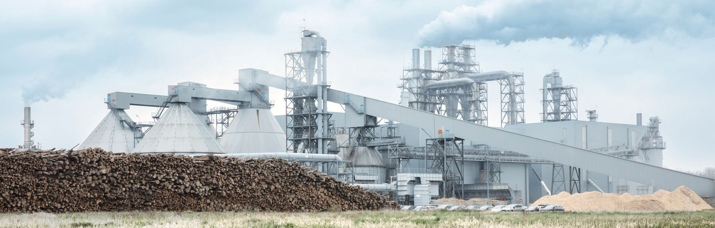
Робоча група Forest-LidaRioja була створена з метою проведення інвентаризації лісів і підготовки карти моделей горючих матеріалів для провінції Ла-Ріоха з використанням технологій дистанційного зондування.
Серед основних практичних переваг можна виділити покращення сталого ведення лісового господарства, оскільки точні й актуальні дані дозволяють приймати кращі рішення та краще планувати лісогосподарські заходи.
Цей проєкт дозволив розробити методології та процеси для інтеграції різних джерел інформації (в основному, це LiDAR на основі даних PNOA 2016 та супутникової інформації OPTICA). Ці методи підтримуються розробкою алгоритмів, які корелюють актуальні дані про місцевість з даними LiDAR за допомогою статистичних методів, що вимагає реалізації лісових ділянок і вимірювань, добре відкаліброваних і розташованих з субметричною точністю у стратегічних точках для кожної породи та робочої зони.
Основні результати проєкту Forest-LidaRioja:
• Інвентаризація лісів провінції Ла-Ріоха.
• Картування моделей горючих матеріалів для лісів Ла-Ріохи з метою планування профілактичних протипожежних заходів.
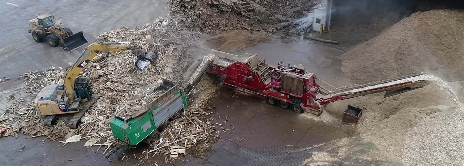
• Вивчення еволюції тополевих гаїв у регіоні та потенційного об’єму поставок.
• Технічне навчання із застосування продуктів, розроблених для зацікавлених фахівців.
Створені продукти відкриті для широкого загалу, тобто будь-хто може їх завантажити і використовувати. 
Eigentümer oder Autorenorganisation
Agresta S. Coop.
Name des Eigentümers oder Autors
Давід Ґарсіа
Organisation der Reporter
CESEFOR
Name des Reporters
Ангела Гарсія де Арана
E-Mail des Reporters
Projekt-Referenz
FEADER
Titel der Ressource 1
Інфраструктура просторових даних уряду провінції Ріоха (IDErioja)
Ressource 2 Titel
Застосунок для консультування й отримання даних щодо конкретних земельних ділянок
Hauptbild
Logo der Best Practice
Logo der Hauptorganisation
Kosten der Implementierung (Euro - €)
243000.00 €
Leichte Implementierung - Bewertung
Very easy
Nabe
South-Western Hub
BP - Rosewood - V1
NO
Potenzial für Nachhaltigkeit - Wert
Very Positive
Herkunftsland
Spanien
Titel (nationaler Name)
Forest-LidaRioja: inventario forestal y mapa de modelos de combustibles basado en teledetección
Umfang der Anwendung
Projekt, in dessen Rahmen dieses Factsheet erstellt wurde
Rosewood Video
Video ansehen
Forest-LidaRioja
Hat Video
yes
Kroatisch
Source of wood

Low-energy windows, low-energy sliding doors

E-Mail des Eigentümers oder Autors
Code
BP_CRO_05
Time scale
2017 - 2020
Art des betroffenen Holzes
Različiti drvni sortimenti
Wirtschaftliche Auswirkungen
Godišnja proizvodnja doseže 16.000 prozora svih vrsta i 3.000 vrata, certificiranih prema standardima IFT Rosenheim, Europinspekt, CE, FSC.
Einkommenseffekt
Pozitivan
Kosten der Implementierung

 ≈2,000,000 euro

Technical readiness level
Applicable immediately
Wichtige Voraussetzungen

Ulaganje u istraživanje, razvoj i inovacije.

Location
Čakovec, Croatia
Implementers
Pana Ltd, Čakovec, Croatia
Actual status
Running
Anhänge
Country Region City
CroatiaMedimurska županija
Scope
Regional
Voting
0%
Startjahr
2017
Endjahr
2020
Kurze Beschreibung
Opći cilj projekta je doprinijeti razvoju novih proizvoda, poboljšanju tehnoloških procesa i jačanju konkurentnosti gospodarstva kroz povećanje ulaganja i kapaciteta za istraživanje, razvoj i inovacije.
Herkunft des Holzes
Art des Holzes
Zusammenfassung

Svrha projekta je razvoj novog proizvoda kroz povećanje privatnih ulaganja u istraživanje, razvoj i inovacije te jačanje kapaciteta Pana WINDOWS d.o.o. za istraživanje, razvoj i inovacije kroz kontinuiranu suradnju s istraživačkim institucijama. 

Projektom će se nabaviti oprema i usluge za provedbu industrijskog istraživanja podložnog učinkovitoj suradnji i opsežnom širenju znanja te zaposliti stručno osoblje.

Projekt doprinosi prioritetnim područjima Strategije pametne specijalizacije Republike Hrvatske za razdoblje 2016. – 2020., područjima Hrana i bioekonomija te Energija i održivi okoliš. Projekt će se realizirati u suradnji s Euroinspekt-drvokontrola d.o.o., a provedba će omogućiti postizanje izvrsnosti u industrijskom istraživanju, razvoju i inovacijama, komercijalizaciju novih proizvoda, rast prihoda i izvoza, što će pozitivno utjecati na nacionalno gospodarstvo.

Eigentümer oder Autorenorganisation
Pana Windows d.o.o.
Organisation der Reporter
Centar kompetencija d.o.o. za istraživanje i razvoj
Name des Reporters
dr.sc. Ivan Ambroš
E-Mail des Reporters
Hauptbild
Hauptbildunterschrift
Pana prozori
Logo der Hauptorganisation
Zusätzliches Bildmaterial 1
Zusätzliches Bildmaterial 2
Leichte Implementierung - Bewertung
Medium
Nabe
Central-East Hub
BP - Rosewood - V1
YES
Potenzial für Nachhaltigkeit - Wert
Very Positive
Herkunftsland
Kroatien
Umfang der Anwendung
Projekt, in dessen Rahmen dieses Factsheet erstellt wurde
Hat Video
no
Ukrainisch
Innovation
Yes
E-Mail des Eigentümers oder Autors
Voting
0%
Titel (Abkürzung)
Drones in forest operator education
Kurze Beschreibung
Ефект навчання підвищується як для спостерігачів, так і для операторів, коли вони бачать свою роботу під новим кутом. До того ж, такий підхід дозволяє здійснювати безпечне спостереження за роботою учнів.
Digitale Lösung
Yes
Zusammenfassung

З моменту свого заснування 75 років тому Solør VGS Sønsterud є національним лідером у навчанні методам ведення лісового господарства. Кампус є частиною Solør VGS і налічує близько 500 учнів віком 16-18 років і 135 працівників. Навчання проходить як у приміщеннях, так і на відкритому повітрі, що дозволяє учням отримати практичний досвід у сфері лісового господарства. Теми навчальної програми відображають етапи річного сезону (планування, лісова культура, лісозаготівля).

Дрони використовуються як доповнення до інших методів навчання, зокрема для зйомки об’єктів і насаджень. Такі записи потрібні для того, щоб показати конкретні проблеми або стан до/ після того чи іншого лісогосподарського заходу. Під час навчання керуванню лісогосподарськими машинами, завдяки дронам учні і вчителі можуть побачити роботу під іншим кутом. За умови правильного застосування, такий підхід може забезпечити ефективніше навчання як для тих, хто спостерігає, так і для тих, за ким спостерігають, адже вони можуть побачити себе в роботі. Оскільки час, який учень проводить за кермом лісогосподарської машини, обмежений, важливо використати його якомога ефективніше. Через знімання кожного учня за кермом лісогосподарської машини можна покращити результати навчання, адже учні можуть побачити себе зі сторони й отримати позитивний і конструктивний зворотний зв'язок. Завдяки дронам, легше виставити пріоритети щодо сфер навчання, яким варто приділити більше уваги.

Eigentümer oder Autorenorganisation
Вища школа Solør
Name des Eigentümers oder Autors
Завкафедри Хельге Стреткверн
Organisation der Reporter
Tretorget A/S
Name des Reporters
Ола Ростад
E-Mail des Reporters
Hauptbild
BP - Rosewood - V1
NO
Herkunftsland
Norwegen
Titel (nationaler Name)
Use of drones educating forestry operators at Solør High School
Umfang der Anwendung
Projekt, in dessen Rahmen dieses Factsheet erstellt wurde
Hat Video
no
Ukrainisch
Innovation
Yes
Voting
0%
Titel (Abkürzung)
SAT4EST
Kurze Beschreibung
Науково-дослідний проєкт, мета якого – розробити простий, інтуїтивно зрозумілий та бюджетний інструмент у вигляді веб-додатку, який би об’єднував супутникові дані з іншими даними, дозволяв збирати статистику для певної території і генерував прості звіти
Digitale Lösung
Yes
Zusammenfassung

SAT4EST – це науково-дослідний проєкт, що фінансується Європейським космічним агентством (ESA), спрямований на розробку сервісу для підтримки місцевих органів влади в управлінні недержавними лісами (на рівні NUTS-4). Основна мета проєкту – розробити простий, інтуїтивно зрозумілий та бюджетний інструмент у вигляді веб-додатку, який би об’єднував супутникові дані з даними, отриманими з інших джерел, дозволяв збирати статистику для певної території і генерував прості звіти.

Система складається з чотирьох окремих елементів: дані дистанційного зондування (зберігання, аналіз даних і створення нових продуктів відповідно до вимог користувачів); зберігання додаткових даних; обробка даних і картографічний сервер; перегляд даних спостереження за Землею. Останній компонент включає надання користувачам сервісних продуктів (WMS, візуалізація, аналіз) та інструмента для візуалізації супутникових знімків. На основі зібраних та опрацьованих даних можна створювати різні типи карт, зокрема карти лісів і дерев, карти змін у лісах, карти типів лісів, карти стану лісів, карти зімкнутості лісового намету, карти наземної лісової біомаси та деградації лісових насаджень. Користувачі системи мають доступ до найновіших та заархівованих супутникових знімків, можуть порівнювати різні продукти (карти) з наявними додатковими даними, а також завантажувати власні набори даних. 

Eigentümer oder Autorenorganisation
Taxus IT Sp. z o.o.
Organisation der Reporter
Науково-дослідна мережа Лукасевича - Інститут деревинних технологій (ITD)
Name des Reporters
Доброхна Августиняк-Висоцька
Projekt-Referenz
Система підтримки місцевих органів влади в управлінні недержавними лісами (SAT4EST), створення якої фінансується Європейським космічним агентством (ESA) через Польську програму стимулів
Hauptbild
Logo der Best Practice
Nabe
Central-East Hub
BP - Rosewood - V1
NO
Herkunftsland
Polen
Titel (nationaler Name)
System wspierający lokalną administrację w zarządzaniu lasami niepaństwowymi
Umfang der Anwendung
Projekt, in dessen Rahmen dieses Factsheet erstellt wurde
Hat Video
no
Englisch
Innovation
Yes
Voting
0%
Kurze Beschreibung
Post-consumer wood from urban areas is collected, cleaned and processed in high tech recycling plants to re-convert into viable raw material for quality board products for furniture and interior use.
Digitale Lösung
Yes
Herkunft des Holzes
Zusammenfassung

UNILIN represents one of the most advanced recycling systems for valorizing post-consumer wood waste streams on large industrial scale. It relies on an established collection system and supplier network. Cascading wood reduces the need for fresh roundwood and prolongs the carbon capture. Particle boards from recovered wood are a prime case for Circular Economy in the sector. Highlights of innovative features :

  • Large investments in high tech sorting and cleaning equipment enables the processing of huge volumes of demolition and urban waste: up to 1 million tons are recycled into panels per year.
  • Chipboards are produced with up to 90% recycled wood.
  • To offset carbon emissions, factories are powered 70-90% by renewable energy from wood waste that cannot be recycled.
  • Partnerships with a large supplier network including container parks, demolition firms, packaging and furniture industries ensure the recovery of large wood volumes that are no longer usable for other processes.
Eigentümer oder Autorenorganisation
UNILIN Panels
Organisation der Reporter
InnovaWood asbl
Name des Reporters
Uwe Kies
E-Mail des Reporters
Projekt-Referenz
WoodCircus - Horizon 2020 no. 820892, 2018-2021
Titel der Ressource 1
UNILIN good practice factsheet
Ressource 1 Datei-Upload
Hauptbild
Logo der Hauptorganisation
Logo des Projekts
Zusätzliches Bildmaterial 1
Zusätzliches Bildmaterial 2
Zusätzliches Bildmaterial 3
BP - Rosewood - V1
NO
Herkunftsland
Belgien
Umfang der Anwendung
Projekt, in dessen Rahmen dieses Factsheet erstellt wurde
Rosewood Video
Video ansehen
UNILIN video clips
Hat Video
yes