2. Förbättra infrastruktur och kapacitet hos offentliga aktörer

Spanska
Innovasion
Yes
E-postadress för ägaren eller författaren
Mobiliseringspotential
Difícil de definir, pero basando se en las cortas anuales y en las posibilidades en la Rioja podría ponerse entre 100.000 y 250.000 m3 de madera, pero no sería sólo por este sistema.
Typ av trä
Madera en pie
Hållbarhets potential
Facilitar la gestión forestal sostenible y la movilización de madera
Påverkan på miljö & biologisk mångfald

Difícil de estimar.

Enkel implementering
Se ha creado una aplicación de uso muy sencillo para que sea fácil de utilizar por todos, con una variante básica para todos los públicos de uso intuitivo y una variante más avanzada para técnicos (esta última se acompañó de una formación)
ekonomisk påverkan
Alto a la escala de usuarios forestales, facilita muchos procesos ligados a los servicios públicos forestales y disminuye costes de inventario tanto para usuarios públicos como privados.
Specifika kunskapsbehov
Para la variante todos los públicos ninguno, sólo conocer la localización de la parcela y disponer de acceso a internet, para la variante técnica conocimientos propio de ingenieros forestales y algunos rudimentos de uso de la aplicación.
Kostnader för implementering

Gratuito para usuarios

Voting
0%
Startår
2018
Slutår
2020
Titel (förkortning)
Forest-LidaRioja
Kort beskrivning
<p>Este proyecto ha creado una cartografía actualizada de las principales especies forestales de La Rioja, recogiendo datos como el volumen de madera, las alturas de los árboles y la estructura de la vegetación para cada 25x25m de terreno, con un nivel de resolución muy alto.</p>
Digital lösning
Yes
Vedens ursprung
Sammandrag

El grupo operativo Forest-LidaRioja se ha constituido con el objetivo de desarrollar un inventario forestal y un mapa de modelos de combustible de La Rioja utilizando tecnologías de teledetección.

Entre las principales utilidades prácticas, destaca la importancia para la mejora de la gestión forestal sostenible, ya que con datos precisos y actualizados se pueden tomar mejores decisiones y planificar mejor las actuaciones en las zonas forestales.

Este proyecto ha permitido el desarrollo de metodologías y procesos para la integración de diferentes fuentes de información (principalmente LiDAR aerotransportado de datos PNOA 2016 e información satelital OPTICA). Estos métodos se apoyan en el desarrollo de algoritmos que correlacionan por métodos estadísticos los datos precisos del terreno con los datos LiDAR, requiriendo la realización de parcelas forestales muy bien calibradas y mediciones localizadas con precisión submétrica en puntos estratégicos para cada especie forestal y zona de trabajo.

Los principales resultados del Proyecto Forestal-LidaRioja son:

- Inventario forestal de los bosques de La Rioja.

- Cartografía de modelos de combustible de la zona forestal de La Rioja para planificar los trabajos de prevención de incendios forestales.

- Estudio de la evolución de las choperas de la región y su potencial de abastecimiento.

- Formación técnica sobre los productos generados para los profesionales interesados en su uso práctico. 

Los productos generados están abiertos al público para que cualquier persona pueda descargarlos y utilizarlos.

Ägare eller författarorganisation
Agresta S. Coop.
Namn på ägaren eller författaren
David García
Rapportör
CESEFOR
Namn på rapportören
Ángela García de Arana
E-post till rapportören
Projektreferens
FEADER
Titel resurs 1
Spatial Data Infrastructures of the Government of La Rioja (IDErioja)
Titel resurs 2
Application for consulting and extracting data from specific plots of land
Huvudbild
Logo för best practice
Logo, huvudorganisation
Kostnader för implementering (Euro - €)
243000.00 €
Enkel implementering - Utvärdering
Very easy
Nav
South-Western Hub
BP - Rosewood - V1
NO
Hållbarhets potential - Värde
Very Positive
Upphovsland
Spanien
Projekt som detta factsheet skapats inom
Rosewood Video
Watch video
Forest-LidaRioja
Har video
yes
Slovenska
Innovasion
Yes
E-postadress för ägaren eller författaren
Voting
0%
Kort beskrivning
<table border="0" cellpadding="0" cellspacing="0" style="width:252px;" width="252"> <tbody> <tr height="60"> <td height="60" style="height:60px;width:252px;">Digitalizacija terenskih podatkov</td> </tr> </tbody> </table>
Digital lösning
Yes
Sammandrag

MightyFields podjetjem omogoča, da ustvarijo digitalne pametne obrazce s preprostim oblikovalcem obrazcev "povleci in spusti", da svoje podatke delijo s svojimi terenskimi ekipami brez potrebne tehnične podpore, imajo pregled nad vsemi nalogami na terenu in imajo poročila na voljo takoj. Podatke lahko uporabite tudi v svojih trenutnih aplikacijah z našim preprostim orodjem za integracijo API-ja Mightyfields.

Ägare eller författarorganisation
Comland d.o.o
Namn på ägaren eller författaren
Comland d.o.o
Rapportör
Slovenian Forestry Institute
E-post till rapportören
Huvudbild
Ytterligare bild 1
BP - Rosewood - V1
NO
Upphovsland
Slovenien
Potential
Projekt som detta factsheet skapats inom
Har video
no
Engelska
Innovasion
Yes
E-postadress för ägaren eller författaren
Voting
0%
Kort beskrivning
<table border="0" cellpadding="0" cellspacing="0" style="width:357px;" width="357"> <tbody> <tr height="60"> <td height="60" style="height:60px;width:357px;">Digitalisation of fieldwork data collection</td> </tr> </tbody> </table>
Digital lösning
Yes
Sammandrag

MightyFields enables companies to create digital smart forms with a simple drag and drop form designer, to share your data with your field teams with no tech support needed, have an overview of all tasks on the field and to have reports available instantly. You can also use the data in your current applications with our simple Mightyfields API integration tool.

Ägare eller författarorganisation
Comland d.o.o
Namn på ägaren eller författaren
Comland d.o.o
Rapportör
Slovenian Forestry Institute
Namn på rapportören
Polona Hafner
E-post till rapportören
Huvudbild
Ytterligare bild 1
BP - Rosewood - V1
NO
Upphovsland
Slovenien
Potential
Projekt som detta factsheet skapats inom
Har video
no
Kroatiska
Innovasion
Yes
E-postadress för ägaren eller författaren
Voting
0%
Startår
2013
Kort beskrivning
<table border="0" cellpadding="0" cellspacing="0" style="width:419px;" width="418"> <tbody> <tr height="60"> <td height="60" style="height:60px;width:419px;">Javni podaci o šumama u obliku aplikacije sadrže pregled javnih podataka o državnim i privatnim šumama. </td> </tr> </tbody> </table>
Digital lösning
Yes
Vedens ursprung
Sammandrag

Hrvatske šume d.o.o. je tvrtka koja gospodari državnim šumama i šumskim zemljištem u Hrvatskoj. Navedena tvrtka je razvila aplikaciju koja pruža vektorski pregled za 16 uprava šuma, podružnica Hrvatskih šuma i to do razine odjela. Također, aplikacija prikazuje i podatke za privatne šume za koje postoji odobren plan gospodarenja.

Aplikacija u kartografskom prikazu omogućuje pregled informacija u tekstualnom i tabličnom obliku, kao i prostorni prikaz vrste drveća u određenoj šumi ili području. Omogućen je  prikaz i dva parametra za svaku vrstu drva: ukupan obujam debla i godišnji rast. Vektorski podaci o granicama područja gospodarenja (uprave šuma, šumarije, gospodarske jedinice, itd.) za državne i privatne šume prikazani su na Google Maps kartografskoj podlozi.

Osim osnovnih informacija o upravama šuma, podružnicama i šumarijama do razine gospodarskih jedinica, omogućen je pregled komisijskih zapisnika i određenih rješenja o odobrenju osnove gospodarenja za gospodarsku jedinicu kao i rekapitulacije obrazaca s prikazom drvne mase i prirasta po vrstama drveća.

Aplikacija je inovativno rješenje obzirom da na jednom mjestu korisniku pruža pregled i informacije o državnim i privatnim šumama te besplatno za korištenje i dostupno online. 

Ägare eller författarorganisation
Hrvatske šume d.o.o.
Rapportör
Centar kompetencija d.o.o. za istraživanje i razvoj
Namn på rapportören
dr.sc. Ivan Ambroš
E-post till rapportören
Titel resurs 1
Prikaz aplikacije
Huvudbild
Huvudbildens bildtext
Prikaz aplikacije Javni podaci o šumama
Logo, huvudorganisation
Enkel implementering - Utvärdering
Very easy
Nav
Central-East Hub
BP - Rosewood - V1
NO
Hållbarhets potential - Värde
Very Positive
Upphovsland
Kroatien
Potential
Projekt som detta factsheet skapats inom
Rosewood Video
Watch video
Javni podaci o šumama
Har video
yes
Engelska
Innovasion
Yes
E-postadress för ägaren eller författaren
Voting
0%
Startår
2013
Kort beskrivning
Public data of forest in the form of application, contains overview of data about state and privately owned forests.
Digital lösning
Yes
Vedens ursprung
Sammandrag

Croatian Forests Ltd is national company which manage public forests and forest land in Croatia. The company developed application which contains vector data for all 16 forest administrations of Croatian Forests. Also, the application contains information about private forests which have approved management program.

Application in cartographic form presents information in textual and tabular views, as well as spatial illustration of tree species in specific forest or area. Also, application shows two parametars for every tree specie: the total volume of timber and annual growth. Vector data about borders of management areas (forest administrations, forests units, economic units, etc.) for state and private forests are shown in the form of Google Maps basis.

Except basic information on forest administrations and units, commission minutes and approvements of the management basis for economic unit and recapitulations of forms  showing wood mass and increments of tree species, are available.

Application is an innovative solution which provides an overview and information about state and private forests in one place.

Innovative solution is free for public use and available online.

Ägare eller författarorganisation
Croatian Forests Ltd
Rapportör
Competence Centre Ltd. for research and development
Namn på rapportören
Phd Ivan Ambroš
E-post till rapportören
Titel resurs 1
Public data
Huvudbild
Huvudbildens bildtext
Public data of forests - application
Logo, huvudorganisation
Enkel implementering - Utvärdering
Very easy
Nav
South-Eastern Hub
BP - Rosewood - V1
NO
Hållbarhets potential - Värde
Very Positive
Upphovsland
Kroatien
Potential
Projekt som detta factsheet skapats inom
Rosewood Video
Watch video
Public data of forests
Har video
yes
Engelska
Innovasion
Yes
E-postadress för ägaren eller författaren
Mobiliseringspotential
Difficult to define, but if we base ourselves on the annual felling and the possibilities in La Rioja, it could be between 100,000 and 250,000 m3 of wood, but it would not be only through this system.
Typ av trä
Wood standing
Hållbarhets potential
Facilitating sustainable forest management and the mobilisation of timber
Påverkan på miljö & biologisk mångfald

Difficult to estimate

Enkel implementering
A very easy-to-use application has been created to make it user-friendly for everyone, with a basic variant for all audiences that is intuitive to use and a more advanced variant for technicians (the latter was accompanied by training).
ekonomisk påverkan
High at the scale of forest users, facilitates many processes linked to public forest services and lowers inventory costs for both public and private users.
Effekt antal anställda
Difficult to specify
Specifika kunskapsbehov
For the all public variant none, only knowledge of the location of the plot and internet access, for the technical variant knowledge of foresters and some rudiments of using the application.
Kostnader för implementering

Free for users

Voting
0%
Startår
2018
Slutår
2020
Kort beskrivning
<p><span style="color: rgb(68, 68, 68); font-family: Calibri, sans-serif, &quot;Mongolian Baiti&quot;, &quot;Microsoft Yi Baiti&quot;, &quot;Javanese Text&quot;, &quot;Yu Gothic&quot;; font-size: 14.6667px; white-space: pre;">This project has created an updated cartography of the main forest species in La Rioja, collecting data such as the volume of wood, tree heights and vegetation structure for every 25x25m of land, with a very high level of resolution.</span></p>
Digital lösning
Yes
Vedens ursprung
Sammandrag

The Forest-LidaRioja operational group has been formed with the aim of developing a forest inventory and a fuel model map of La Rioja using remote sensing technologies. Among the main practical utilities, we can highlight the importance for improving sustainable forest management, since with accurate and updated data, better decisions can be made and actions in forest areas can be better planned. This project has allowed the development of methodologies and processes for the integration of different sources of information (mainly airborne LiDAR from PNOA 2016 data and OPTICA satellite information). These methods are supported by the development of algorithms that correlate by statistical methods precise terrain data with LiDAR data, requiring the realization of very well calibrated forest plots and measurements located with sub-meter precision in strategic points for each forest species and working area.

The main results of the Forest-LidaRioja Project are:

  • Forest inventory of the forests of La Rioja.
  • Mapping of fuel models of the forest area of La Rioja to plan preventive forest fire prevention work.
  • Study of the evolution of poplar groves in the region and their supply potential.
  • Technical training on the products generated for professionals interested in their practical use. 

The products generated are open to the public so that anyone can download and use them.

Ägare eller författarorganisation
Agresta S. Coop.
Namn på ägaren eller författaren
David García
Rapportör
CESEFOR
Namn på rapportören
Ángela García de Arana
E-post till rapportören
Projektreferens
FEADER
Titel resurs 1
Spatial Data Infrastructures of the Government of La Rioja (IDErioja)
Titel resurs 2
Application for consulting and extracting data from specific plots of land
Huvudbild
Logo för best practice
Logo, huvudorganisation
Kostnader för implementering (Euro - €)
243000.00 €
Enkel implementering - Utvärdering
Very easy
Nav
South-Western Hub
BP - Rosewood - V1
NO
Hållbarhets potential - Värde
Very Positive
Upphovsland
Spanien
Projekt som detta factsheet skapats inom
Rosewood Video
Watch video
Forest-LidaRioja
Har video
yes
Polska
Innovasion
Yes
E-postadress för ägaren eller författaren
Voting
0%
Startår
2017
Slutår
2019
Titel (förkortning)
SAT4EST
Kort beskrivning
Projekt B+R, którego celem jest rozwój prostej, intuicyjnej i ekonomicznej aplikacji internetowej wspomagającej zarządzanie lasami, integrującej dane satelitarne z danymi pozyskiwanymi z innych źródeł
Digital lösning
Yes
Sammandrag

SAT4EST to projekt B+R finansowany przez Europejską Agencję Kosmiczną (ESA), którego celem jest zaprojektowanie systemu i zbudowanie serwisu wspomagającego zarządzanie lasami niepaństwowymi, dedykowanego dla administracji lokalnej (na poziomie NUTS-4). Głównym założeniem projektu jest rozwój prostej, intuicyjnej i ekonomicznej aplikacji internetowej wspomagającej zarządzanie lasami, integrującej dane satelitarne z danymi pozyskiwanymi z innych źródeł, umożliwiającej obliczanie statystyk dla danego obszaru i generowanie prostych raportów.

System składa się z czterech komponentów:

  • dane satelitarne  – szybki dostęp do dostęp do danych aktualnych i historycznych, umożliwiający porównywanie zdjęć satelitarnych z różnych okresów;
  • dane uzupełniające  - dane katastralne oraz szczegółowe dane o lasach pochodzące z planów urządzenia lasu (UPUL);
  • produkty przetwarzania danych satelitarnych – warstwy geometryczne będące wynikiem przetwarzania zdjęć satelitarnych obrazujące stan i kondycję roślinności i lasów;
  • analizy – zestawienie produktów przetwarzania danych satelitarnych z danymi katastralnymi oraz szczegółowymi danymi o lesie, umożliwiające wychwycenie niezgodności pomiędzy stanem faktycznym a stanem zapisanym w bazach danych oraz bieżących zmian.

Całość rozwiązania opera się na intuicyjnym portalu mapowym przeznaczonym dla użytkowników,  który służy do generowanie różnego typu map, w tym map lasów i zadrzewień, zmian w lasach, map typów lasu, map kondycji lasu, map zwarcia koron, map nadziemnej biomasy leśnej oraz zasięgu zniszczenia drzewostanów wskutek huraganów, pożarów, powodzi i gradacji owadów. Użytkownicy systemu mają dostęp do aktualnych i archiwalnych obrazów satelitarnych, mogą porównywać różne rodzaje map z danymi uzupełniającymi i przesyłać własne zestawy danych. 

Ägare eller författarorganisation
Taxus IT Sp. z o.o.
Namn på ägaren eller författaren
Sylwester Kulik
Rapportör
Łukasiewicz Research Network - Wood Technology Institute (ITD)
Namn på rapportören
Dobrochna Augustyniak-Wysocka
Huvudbild
Logo för best practice
Nav
Central-East Hub
BP - Rosewood - V1
NO
Upphovsland
Polen
Titel (nationellt namn)
[EN] Earth observation based service supporting local administration in non-state forest management
Projekt som detta factsheet skapats inom
Har video
no
Polska
Innovasion
No
E-postadress för ägaren eller författaren
Voting
0%
Titel (förkortning)
BDL
Kort beskrivning
<table border="0" cellpadding="0" cellspacing="0" style="width:524px;" width="524"> <tbody> <tr height="60"> <td height="60" style="height:60px;width:524px;">Hurtownia danych mająca na celu gromadzenie, przetwarzanie i udostępnianie informacji dotyczacych lasów wszystkich rodzajów własności w Polsce. Dane dostepne są w formie opisowej i kartograficznej, poprzez portal internetowy i aplikację mobilną.&nbsp;</td> </tr> </tbody> </table>
Digital lösning
Yes
Sammandrag

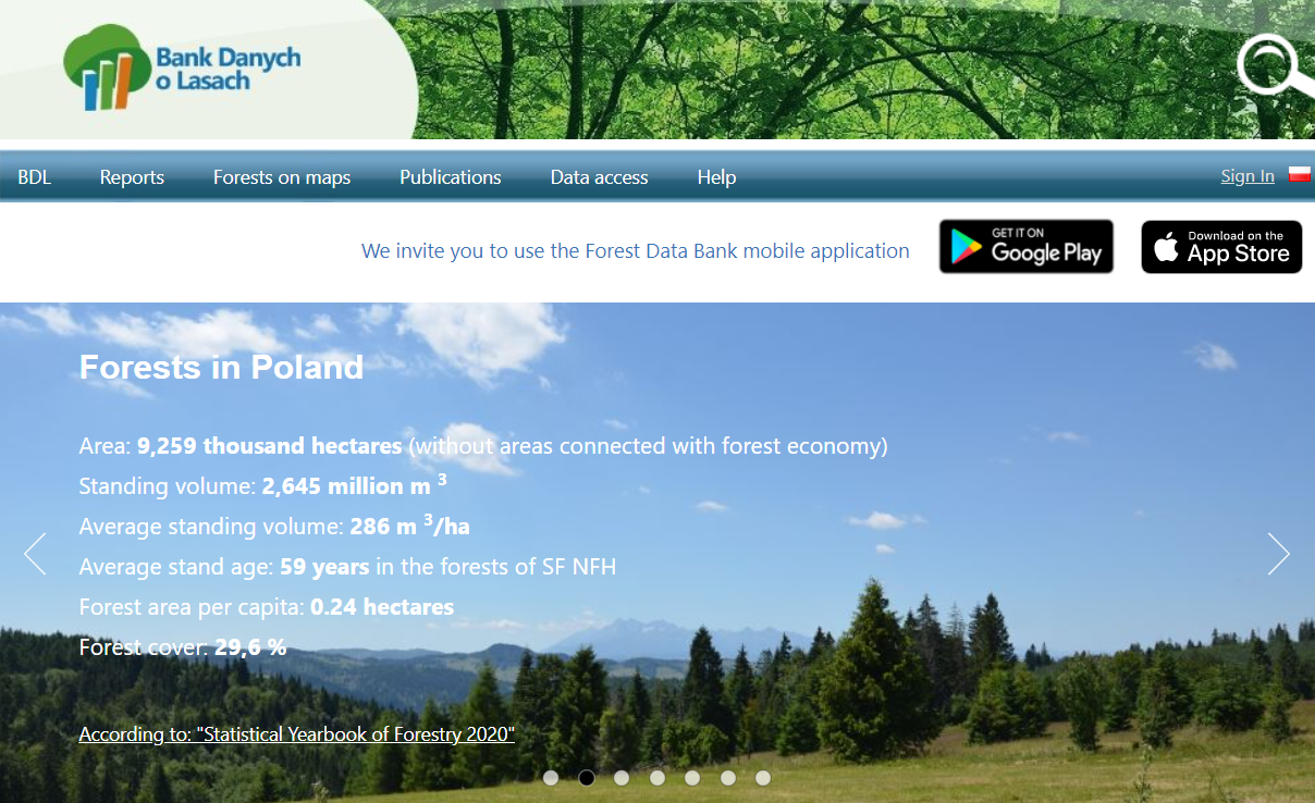
Bank Danych o Lasach jest hurtownią danych mającą na celu gromadzenie, przetwarzanie i udostepnianie informacji dotyczących lasów wszystkich typów własności w Polsce. Ponadto, wśród celów BDL znajduje się wspieranie badań naukowych, umożliwienie wykonywania analiz i prognozowania zasobów leśnych oraz promowanie standardów zbierania i przetwarzania danych o zasobach przyrodniczych.

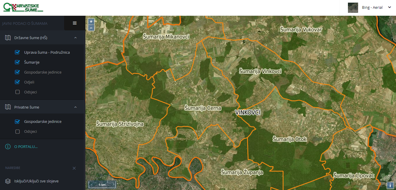
W Banku Danych o Lasach dostepne są zarówno dane w formie opisowej jak i kartograficznej. Zakres dostepnych danych obejmuje dane taksacyjne i prognostyczne oraz dodatkowe dane dotyczące: ochrony lasów, ochrony przeciwpożarowej, ochrony przyrody, monitoringu środowiska, hydrologii, klimatologii, geologii, regionalizacji przyrodniczo–leśnej, leśnych obszarów funkcjonalnych, regionalizacji nasiennej, Państwego Rejestru Granic. Z BDL skorzystać można za pośrednictwem portalu internetowego (na którym znaleźć można także raporty, publikacje i mapy) oraz aplikacji mobilnej (mBDL), która oferuje dostęp do map i nawigacji.

Główną grupą odbiorców są leśnicy, ale Bank Danych o Lasach wykorzystywany jest również do celów planowania przestrzennego, nauki, statystyki publicznej i międzynarodowej, a także turystyki. System dostarcza danych na poziomie centralnym, regionalnym i lokalnym i obejmuje ok. 95% lasów w Polsce (jedno z najbardziej kompletnych zestawień danych o lasach, w porównaniu do innych krajów, które dysponuja podobnymi rozwiązaniami). Każdego miesiąca portal BDL odwiedza ponad 25 tys. użytkowników.

Ägare eller författarorganisation
PGL Lasy Państwowe
Namn på ägaren eller författaren
PGL Lasy Państwowe
Rapportör
Łukasiewicz Research Network - Wood Technology Institute (ITD)
Namn på rapportören
Dobrochna Augustyniak-Wysocka
Huvudbild
Nav
Central-East Hub
BP - Rosewood - V1
NO
Upphovsland
Polen
Titel (nationellt namn)
Bank Danych o Lasach
Potential
Projekt som detta factsheet skapats inom
Rosewood Video
Watch video
Bank Danych o Lasach Polska
Har video
yes
Engelska
Innovasion
Yes
E-postadress för ägaren eller författaren
Voting
0%
Kort beskrivning
<table border="0" cellpadding="0" cellspacing="0" style="width:601px;" width="601"> <tbody> <tr height="60"> <td height="60" style="height:60px;width:601px;">Mounted at the towing hitch, sensor values are collected and the road quality of unpaved, single lane roads gets assesd. Ultrasonic sensors (cross section scan of a road segment) acceleration sensors to assess the longitudinal roughness and a GPS sensor for locatiion.&nbsp;</td> </tr> </tbody> </table>
Digital lösning
Yes
Sammandrag

Scanner is under constant development. A measuring device, mounted at the towing hitch of a car. Sensors collect values, to assess the road quality of unpaved, single lane roads. The system consists of ultrasonic sensors to scan the cross section of a road segment, acceleration sensors to get information about the longitudinal roughness and a GPS sensor for locating the information. After data collection, an open configurable software bundle (implemented as GUI modules in iFOS) allows individual settings for the single sensor thresholds and algorithms to adopt the system to the own road maintenance concept. Mounted at the car of the forest ranger an easy and frequent data collection is possible and provides an early and objective knowledge about the constructional decline of road segments. Maintenance costs can  be reduced and reconstruction measures get execute mor accurate.  A logical data interpretation of the sensor values is possible. The assignment of the sensors towards different decay expressions on the road surface was conducted and semi- automatically related to road quality segment classification. Results show, that a single manual optical assessment of road segments miss first phases of road decay and underlines the potential of such systems. Tests and calibrations of the road-scanner allows a good data interpretation for the set task. Many degrees of freedom of the scanner and the data interpretation still leaves some open research questions.

Ägare eller författarorganisation
Thüringenforst
Namn på ägaren eller författaren
Sergej Chmara
Rapportör
BFH Berne University of Applied Sciences
Namn på rapportören
Moritz Dreher
E-post till rapportören
Titel resurs 1
FORMEC conference paper (2016)
Huvudbild
BP - Rosewood - V1
NO
Upphovsland
Tyskland
Schweiz
Titel (nationellt namn)
Messlanze
Projekt som detta factsheet skapats inom
Har video
no
Engelska
Innovasion
Yes
E-postadress för ägaren eller författaren
Voting
0%
Titel (förkortning)
MOTI
Kort beskrivning
<table border="0" cellpadding="0" cellspacing="0" style="width:568px;" width="568"> <tbody> <tr height="60"> <td height="60" style="height:60px;width:568px;">Forest stand inventory with the aid of the Smartphones capabilities (App). Easy, cheap and reliable tool for determining the most important dendrometer indicators (key figures of tree stands). Suitable for single tree measurement or stand inventories.</td> </tr> </tbody> </table>
Digital lösning
Yes
Sammandrag
Forest stand inventory with the aid of the Smartphones capabilities (App). Easy, cheap and reliable tool for determining the most important dendrometer indicators (key figures of tree stands). Suitable for single tree measurement or stand inventories. Easy and fast implementation of forest inventories and single tree measurement.
Possible determination of the base area (m2/ha) with or without the distinction of different tree species. Trunk rate (#/ha), stand height (m/ha), reserve of rough wood (m3/ha). Smartphones can be used as a good referencing tool for forest inventories and forest operation planning. Many further application developments and integrations thinkable.
Ägare eller författarorganisation
BFH Berne University of Applied Sciences
Namn på ägaren eller författaren
Christian Rosset
Rapportör
BFH Bern University of Applied Sciences
Namn på rapportören
Moritz Dreher
E-post till rapportören
Huvudbild
BP - Rosewood - V1
NO
Upphovsland
Schweiz
Titel (nationellt namn)
MOTI
Potential
Projekt som detta factsheet skapats inom
Har video
no