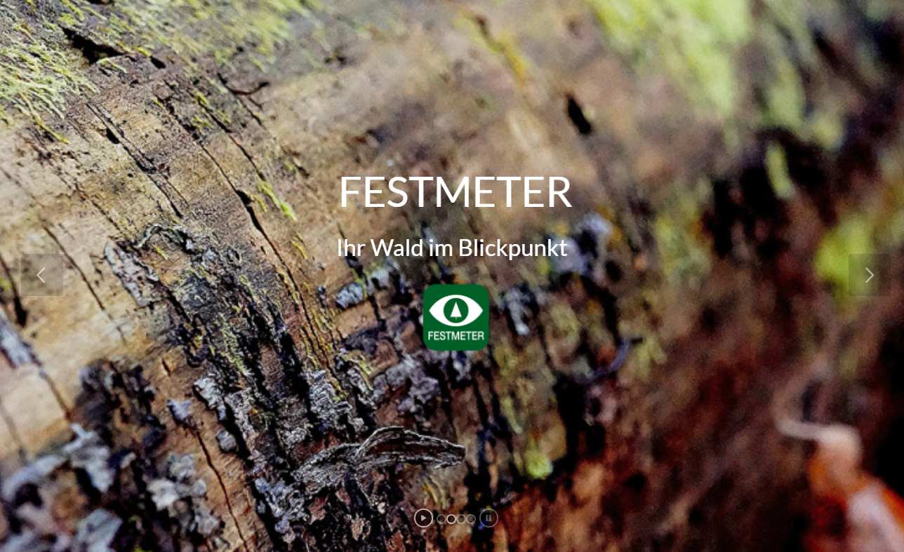
Czujniki, sprzęt pomiarowy

Niemiecki
Innowacja
Yes
Właściciel lub autor e-mail
Id: 2861876
Continent Code: EU
Country Code: DE
Country Name: Germany
Name: North Rhine-Westphalia
Voting
0%
Rok rozpoczęcia
2019
Krótki opis
KI-gestütztes Sensorsystem zur dauerhaften Überwachung von Umweltparametern in Waldbeständen
Rozwiązanie cyfrowe
Yes
Abstrakt

Mit Aja hat das Start-up-Unternehmen foldAI eine Lösung für das Monitoring des Waldzustands entwickelt, die eine konkrete Entscheidungsunterstützung für die Durchführung forstlicher Maßnahmen liefert und gleichzeitig ein umfassendes Verständnis der Waldökosysteme ermöglicht. Durch den Einsatz von modernstem maschinellem Lernen auf der Grundlage präziser Sensordaten in Echtzeit erlaubt Aja nicht nur, Waldbedrohungen sehr früh zu erkennen, sondern ihre Entstehung vorherzusagen und den weiteren Verlauf zu prognostizieren. Aja verbessert die Gesundheit, die Widerstandsfähigkeit und die bioökonomische Leistung der Wälder, indem es schlanke Prozesse für ein Ökosystemmanagement auf breiter Basis ermöglicht. Waldbewirtschaftung wird durch eine vollautomatische, hochauflösende und erschwingliche Lösung für mehr als 30 Millionen Waldbesitzer in Europa, Russland und Nordamerika unterstützt.  Aja basiert auf eingebettetem maschinellem Lernen und biochemischer und ökologischer Signalverarbeitung auf hochdimensionalen Daten. Anwendungsszenarien sind etwa die Bewertung von Umweltauswirkungen, die eine genauere Abschätzung der Umweltfolgen einer Strategie oder Politik ermöglicht, aber auch die Risikobewertung und Warnung vor akuten Bedrohungen. Darüber hinaus erlaubt die Lösung auch die Messung der biologischen Vielfalt und des Zustands von Ökosystemen. Die signifikante Auswirkung von Aja auf die Kohlenstoffreduzierung wurde von unabhängiger Seite durch The Climate Impact Forecast zertifiziert.


Właściciel lub organizacja autorska
foldAI
Właściciel lub twórca
Dr. Friedrich Förster
Organizacja reporterska
Forstliches Bildungszentrum NRW
Osoba przygotowująca fiszkę
Dr. Marie-Charlotte Hoffmann
Zdjęcie główne
Logo dobrej praktyki
Dodatkowe materiały 1
Region pochodzenia
2861876
BP - Rosewood - V1
NO
Kraj pochodzenia
Niemcy
Skala aplikacji
Projekt, w ramach którego stworzona została niniejsza fiszka
Rosewood Video
Posiada wideo
yes
Angielski
Innowacja
Yes
Właściciel lub autor e-mail
Potencjał dla zrównoważonego rozwoju
Sustainable forest management is strongly supported by real time data on the forest's health status
Wpływ na środowisko i bioróżnorodność

The solution helps to monitor ecosystem functions of forests and biodiversity, thereby improving risk management 

Id: 2861876
Continent Code: EU
Country Code: DE
Country Name: Germany
Name: North Rhine-Westphalia
Voting
0%
Rok rozpoczęcia
2019
Krótki opis
Forest health solution built upon an innovative sensor technology for real-time ecosystem monitoring
Rozwiązanie cyfrowe
Yes
Abstrakt

The startup foldAI has developed sensors to screen health status of forests providing forest managers with a rich understanding of their forest ecosystems, and a decision toolbox to deploy immediate mitigating actions. The team’s solution, Aja, used in the sensors is  a framework for ecosystem management based on deep technology. By harnessing state-of-art Machine Learning on precise, real-time sensor data, Aja can not only detect forest threats as they happen, but even predict their arising and forecast their unfolding. Aja improves forest health, resilience and bioeconomical performance by introducing lean processes to a broad ecosystem management community. It helps reducing greenhouse emissions by scaling high resolution forest management through a fully automated and affordable solution for more than 30 Million forest owners in Europe, Russia and North America. The solution builds on embedded Machine Learning, and biochemical and environmental signal processing on high-dimensional data. Use cases comprise the assessment of environmental impacts enabling greater accuracy in the evaluation of the environmental consequences of a strategy or policy, risks assessment including alerts to threats, biodiversity quantification and ecosystem health tracking. Aja’s significant carbon reduction impact has been independently certified by The Climate Impact Forecast.

Właściciel lub organizacja autorska
foldAI
Właściciel lub twórca
Dr. Friedrich Förster
Osoba przygotowująca fiszkę
Dr. Marie-Charlotte Hoffmann
Zdjęcie główne
Logo dobrej praktyki
Dodatkowe materiały 1
Region pochodzenia
2861876
BP - Rosewood - V1
NO
Potencjał dla zrównoważonego rozwoju - Wartość
Very Positive
Kraj pochodzenia
Niemcy
Skala aplikacji
Projekt, w ramach którego stworzona została niniejsza fiszka
Rosewood Video
Posiada wideo
yes
Angielski
Innowacja
Yes
Właściciel lub autor e-mail
Główna kategoria
Country Region City
Finland
Voting
0%
Rok rozpoczęcia
2012
Krótki opis
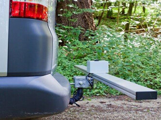
TRESTIMA® is a new and innovative technology for forest inventory. Forest is measured by taking pictures with a mobile application. It automatically recognizes tree species and calculates forest variables, e.g. basal area, stem count, height, volume.
Rozwiązanie cyfrowe
Yes
Abstrakt

TRESTIMA® Forest Inventory System adds accuracy, speed, flexibility and objectivity to forest measurement. You can store different types of GPS-tagged data in the forest and later review your recordings with a computer or mobile device. Using TRESTIMA® is easy. Take a walk in the forest and at the same time create an accurate measurement of the forest by taking pictures with the mobile phone application. You can upload or draw forest compartments prior going to the forest after which you can see your own position and compartment borders in the screen. This makes navigation easy and you just have to shoot pictures evenly while you go. Measuring forests is easy, effective, objective and even fun! Measuring one forest hectare takes on average less than 5 minutes.

TRESTIMA® offers services for different users.  Forest Managers can collect forest data by taking pictures and inputting with the mobile application designed for the purpose. Forest Owners are able to measure the value of their forest with TRESTIMA®-application. Wood buyers can measure forest to be cut fast and with ease to make an ad hoc offer and Realtors make a detailed and accurate estimate of the estate value and share it in a digital format with ease. Government officials may record GPS-tagged data in the field and measure growing timber. In addition, Mill gates and Terminals can measure piles of timber and pulpwood fast and accurately with TRESTIMA® Stack -application. 

Właściciel lub organizacja autorska
Trestima Ltd.
Właściciel lub twórca
Simo Kivimäki, CEO
Organizacja reporterska
Natural Resources Institute Finland (Luke)
Osoba przygotowująca fiszkę
Kari Mäkitalo
E-mail reportera
Zdjęcie główne
Podpis pod zdjęciem głównym
Measure forest and roundwood piles fast and easily by taking pictures
Logo dobrej praktyki
Hub
Northern Hub
BP - Rosewood - V1
NO
Kraj pochodzenia
Finlandia
Skala aplikacji
Posiada wideo
yes
Ukraiński
Innowacja
Yes
Właściciel lub autor e-mail
Voting
0%
Rok rozpoczęcia
2018
Rok zakończenia
2021
Krótki opis
Інноваційний науково-дослідний проєкт, спрямований на побудову системи розпізнавання запахів (так званий електронний ніс) на основі високочутливих датчиків і штучного інтелекту для моніторингу обраних, особливо небезпечних шкідників лісу.
Rozwiązanie cyfrowe
Yes
Pochodzenie surowca drzewnego
Abstrakt

Поступова зміна клімату та поширення немісцевих патогенів і шкідників є основними причинами все більшої загрози деградації лісів. Водночас, у зв'язку з обмеженням використання хімічних засобів, зростає актуальність біологічних методів моніторингу деревостанів і попередження деградації лісів. Основна мета проєкту – розробка інноваційного пристрою (так званий електронний ніс/ e-NOS) на основі широкосмугових електрохімічних датчиків та нейронних мереж, який би виявляв та аналізував сигнали запаху, скажімо, феромони певних видів комах. Прикладами патогенів і шкідників, охоплених проєктом, є Dendrolimus Pini (L.) та ооміцети Phytophthora.
Розроблена система надає вичерпні та комплексні дані, які дозволяють створити нейронний класифікатор за допомогою методів штучного інтелекту. Розроблено спеціальне програмне забезпечення для аналізу даних і створення бази даних – бібліотеки сигналів, які дозволять виявляти аналіти на місцевості. Для кожного із застосунків, передбачених проєктом (аналіз специфічних запахів), була створена спеціальна матриця датчиків.   

Właściciel lub organizacja autorska
Варшавський технологічний університет, факультет фізики
Właściciel lub twórca
Варшавський технологічний університет, факультет фізики
Organizacja reporterska
Науково-дослідна мережа Лукасевича - Інститут деревинних технологій (ITD)
Osoba przygotowująca fiszkę
Доброхна Августиняк-Висоцька
Projekt
Прогнозування загроз для лісових екосистем шляхом впровадження інноваційної електронної системи розпізнавання запахів, що співфінансується Національним центром науково-дослідної роботи (програма BIOSTRATEG ІІІ), 2018-2021 рр., угода № BIOSTRATEG3/347105/9/NCBR/2017
Zdjęcie główne
Logo dobrej praktyki
Hub
Central-East Hub
BP - Rosewood - V1
NO
Kraj pochodzenia
Polska
Tytuł (w języku narodowym)
Innowacyjny elektroniczny system rozpoznawania zapachów do prognozowania zagrożeń leśnych
Skala aplikacji
Projekt, w ramach którego stworzona została niniejsza fiszka
Posiada wideo
no
Angielski
Innowacja
Yes
Voting
0%
Rok rozpoczęcia
2019
Krótki opis
<table border="0" cellpadding="0" cellspacing="0" style="width:503px;" width="503"> <tbody> <tr height="76"> <td height="76" style="height:77px;width:503px;">DecectIT is forest fire detection device which detects fire by using different sensors and sends nottification to the application.</td> </tr> </tbody> </table>
Rozwiązanie cyfrowe
Yes
Abstrakt

Fires in the Republic of Croatia are a big problem for forests, given that fire brigades have about 3.000 interventions per year. Average burned area per year is 14.278 ha of forest land. DetectIT provides information of the current situation in the forest area (level of temperature, humidity, carbon monoxide). Device secures fast information about the occurrence of a fire and provides all important data. Devices are located 100-300 meters away in the forest area and communicate with each other via radio waves. Communication between devices can reach even several kilometers so it is possible to cover very large area. Each device has one or more sensors. When the device receives an icreased concentration of flammable gas or smoke, it sends a signal to the other device about occurrence of a fire.

Currently, for sending notification about occurrence of fire, device uses 4G network. In the future for notification sending, it is planned to use the 5G network which can send notification in a shorter time period. Also, it is planed to spread the use of device i.e. setting device in households. Prototype of device is installed and tested on the forest area. Device is developed by high school students of Gymnasium Velika Gorica, Croatia. Group of students signed up on international competition and won 2nd place. 

Właściciel lub organizacja autorska
Gymnasium Velika Gorica
Organizacja reporterska
Competence Centre Ltd. for research and development
Osoba przygotowująca fiszkę
PhD. Ivan Ambroš
E-mail reportera
Materiał dodatkowy 1 - tytuł
Application view
Zdjęcie główne
Podpis pod zdjęciem głównym
Main components of DetectIT
Logo dobrej praktyki
Łatwość wdrożenia - Ocena
Easy
Hub
South-Eastern Hub
BP - Rosewood - V1
NO
Potencjał dla zrównoważonego rozwoju - Wartość
Very Positive
Kraj pochodzenia
Chorwacja
Skala aplikacji
Projekt, w ramach którego stworzona została niniejsza fiszka
Rodzaj wydarzenia, w którym wystąpiła dana BPI
Title of the event (Study visit - T2.3)
2nd South-East Europe Hub Study Visit
Rosewood Video
Posiada wideo
yes
Szwedzki
Innowacja
Yes
Właściciel lub autor e-mail
Voting
0%
Rok rozpoczęcia
2018
Krótki opis
<table border="0" cellpadding="0" cellspacing="0" style="width:539px;" width="539"> <tbody> <tr height="60"> <td dir="LTR" height="60" style="height:60px;width:539px;">Arboair precisionsskogsbruk är en hållbar tjänst som med hjälp av RGB- och multispektrala bilder från drönare, flygplan, helikoptrar eller satelliter kan upptäcka barkbaggarinfekterade eller stressade träd.</td> </tr> </tbody> </table>
Rozwiązanie cyfrowe
Yes
Abstrakt
Idag bygger tekniken för att identifiera granbarkborreangrepp i skogen till stor del på manuellt arbete genom visuella kontroller av skogsområden, där tidiga angrepp nästan är omöjliga att se, medan gamla attacker är lättare att upptäcka. Försök har gjorts för att identifiera tidiga angrepp med hjälp av satellitkartor som ger en bra indikation och kan ses som ett komplement till vår precisionsanalys. Arboair Forest Mapper är en tjänst där du analyserar dina bilder via vår AI. Vår modell är tränad på över 200 000 träd och den har verifierats av skogsförvaltare.

1. Samla in data 

Flyg drönaren själv
Använd en av våra drönarpartners
Använd en av våra satellitdatapartners för högupplösta satellitbilder
2. Analys

Granbarkborreangrepp
Trädslagsfördelning
Trädräkning
Vindfällen 
3. Ta del av ditt resultat

Titta på i Arboairs portal
Skicka resultatet till er egna plattform
Ladda ner och använd i QGIS, ArcGIS, Google Earth eller något annat GIS.

Właściciel lub organizacja autorska
Paper Province
Właściciel lub twórca
Marcus Drugge
Organizacja reporterska
Paper Province
Osoba przygotowująca fiszkę
Gunnar Hellerström
Zdjęcie główne
BP - Rosewood - V1
NO
Kraj pochodzenia
Szwecja
Tytuł (w języku narodowym)
Arboair AB
Skala aplikacji
Projekt, w ramach którego stworzona została niniejsza fiszka
Rosewood Video
Posiada wideo
yes
Niemiecki
Właściciel lub autor e-mail
Główna kategoria
Voting
0%
Rok rozpoczęcia
2016
Krótki opis
<table border="0" cellpadding="0" cellspacing="0" style="width:443px;" width="442"> <tbody> <tr height="60"> <td height="60" style="height:60px;width:443px;">Die "FESTMETER Wöls GmbH"&nbsp; bietet Vitalitätsanalysen in Hinblick auf Borkenkäfererkennung im Nadelwald an.</td> </tr> </tbody> </table>
Rozwiązanie cyfrowe
Yes
Abstrakt

Die „Festmeter Wöls GmbH“  bietet Vitalitätsanalysen in Hinblick auf Borkenkäfererkennung im Nadelwald an. Mit dem Trägersystemen Multikopter oder Leichtflugzeug werden Waldgrundstücke im Rastersystem überflogen und dabei mit einer Spezialkamera Luftbildaufnahmen gemacht, die später am Computer analysiert und ausgewertet werden. Durch die eingesetzte Technologie werden Vitalitätseinschränkungen sichtbar, man sieht Änderungen im Wassergehalt der Nadeln, nicht aber die genaue Ursache wie beispielsweise den Borkenkäfer selbst. Da aber Bildserien aus mindestens zwei zeitlich versetzten Flügen miteinander verglichen werden, können viele andere Ursachen wie Trockenstress ausgeschlossen werden, wodurch man dem Borkenkäfer sehr nahe auf die Spur kommt. In den Vitalitätsanalysen werden Initialbäume gezeigt wobei die Entscheidung über notwendige Maßnahmen erfolgt weiterhin durch das qualifizierte Vor-Ort Mitarbeiter.Eine 100%ige Trefferquote ist unmöglich. Das Ziel sollte sein, im Feld schneller und zielgerichteter agieren zu können. Langjährige Kunden berichten von positiven Trefferquoten von über 80 %.

Właściciel lub organizacja autorska
Festmeter Wöls GmbH
Właściciel lub twórca
Dr. Kurt Wöls
Organizacja reporterska
Holzcluster Steiermark GmbH
Osoba przygotowująca fiszkę
DI Masa Jasarevic
Zdjęcie główne
Logo organizacji
Dodatkowe materiały 1
BP - Rosewood - V1
NO
Kraj pochodzenia
Austria
Tytuł (w języku narodowym)
Borkenkäfer-Erkennung
Skala aplikacji
Projekt, w ramach którego stworzona została niniejsza fiszka
Posiada wideo
no
Polski
Innowacja
Yes
Właściciel lub autor e-mail
Voting
0%
Rok rozpoczęcia
2018
Rok zakończenia
2021
Krótki opis
<table border="0" cellpadding="0" cellspacing="0" style="width:499px;" width="498"> <tbody> <tr height="104"> <td height="104" style="height:104px;width:499px;">Innowacyjny projekt B+R, którego celem jest zbudowanie systemu rozpoznawania zapachów (elektronicznego nosa) opartego na sensorach o dużej czułości oraz sztucznej inteligencji, służącego do monitorowania&nbsp; wybranych szkodników lasów.</td> </tr> </tbody> </table>
Rozwiązanie cyfrowe
Yes
Pochodzenie surowca drzewnego
Abstrakt

Postępujące zmiany klimatyczne oraz rozprzestrzenianie się nierodzimych gatunków są główną przyczyną rosnącego zagrożenia degradacji lasów spowodowanej przez różne patogeny i szkodniki. Jednocześnie, w związku z ograniczeniem stosowania środków chemicznych, zwiększa się znaczenie biologicznych metod ochrony i monitorowania drzewostanów. Głównym celem projektu jest rozwój innowacyjnego urządzenia (elektroniczny nos/e-NOS), opartego o szerokopasmowe czujniki elektrochemiczne i sieć neuronową, które wykrywa i analizuje sygnały zapachowe np. feromony wybranych gatunków owadów. Przykładami patogenów i szkodników branych pod uwagę przy rozwoju e-NOSa dla leśnictwa są Dendrolimus Pini (L.) and Phytophthora oomycetes.

Powstały system dostarcza kompleksowych i złożonych danych, które pozwalają na zbudowanie, za pomocą metod sztucznej inteligencji, klasyfikatora neuronów. Opracowane zostało oprogramowanie umożliwiające analizę danych i stworzenie bazy danych – biblioteki sygnałów, które umożliwiają wykrywanie poszukiwanych analitów w terenie. Dla każdej z aplikacji przewidzianej w projekcie (analizy specyficznych zapachów) stworzona została dedykowana matryca sensoryczna.

Właściciel lub organizacja autorska
Politechnika Warszawska, Wydział Fizyki
Właściciel lub twórca
Politechnika Warszawska, Wydział Fizyki
Organizacja reporterska
Łukasiewicz Research Network - Wood Technology Institute (ITD)
Osoba przygotowująca fiszkę
Dobrochna Augustyniak-Wysocka
Zdjęcie główne
Logo dobrej praktyki
Hub
Central-East Hub
BP - Rosewood - V1
NO
Kraj pochodzenia
Polska
Skala aplikacji
Projekt, w ramach którego stworzona została niniejsza fiszka
Posiada wideo
no
Angielski
Innowacja
Yes
Właściciel lub autor e-mail
Voting
0%
Krótki opis
<table border="0" cellpadding="0" cellspacing="0" style="width:551px;" width="551"> <tbody> <tr height="60"> <td height="60" style="height:60px;width:551px;">Precision forestry service that with the help of RGB and multispectral images from drones, airplanes, helicopters or satellites can detect bark beetle infected or&nbsp;stressed trees.</td> </tr> </tbody> </table>
Rozwiązanie cyfrowe
Yes
Abstrakt

Today, the technology for identifying bark beetle attacks in the forest is largely based on manual work through visual checks of forest areas, where early attacks are almost impossible to see, while old attacks are easier to detect. Attempts have been made to identify damage attacks using satellite radar maps which give a good indication and can be seen as a complementing part to our precision analysis. Arboair Forest Mapper is a service where you analyze your images via our AI. Our model is trained on over 200 000 trees and it is verified by forest managers.

Właściciel lub organizacja autorska
Paper Province
Właściciel lub twórca
Marcus Drugge
Organizacja reporterska
Paper Province
Osoba przygotowująca fiszkę
Gunnar Hellerström
Zdjęcie główne
Arboair forest aerial view
Logo organizacji
Arboair logo
BP - Rosewood - V1
NO
Kraj pochodzenia
Szwecja
Tytuł (w języku narodowym)
Arboair AB
Skala aplikacji
Projekt, w ramach którego stworzona została niniejsza fiszka
Rosewood Video
Posiada wideo
yes
Angielski
Innowacja
Yes
Właściciel lub autor e-mail
Voting
0%
Krótki opis
<table border="0" cellpadding="0" cellspacing="0" style="width:601px;" width="601"> <tbody> <tr height="60"> <td height="60" style="height:60px;width:601px;">Mounted at the towing hitch, sensor values are collected and the road quality of unpaved, single lane roads gets assesd. Ultrasonic sensors (cross section scan of a road segment) acceleration sensors to assess the longitudinal roughness and a GPS sensor for locatiion.&nbsp;</td> </tr> </tbody> </table>
Rozwiązanie cyfrowe
Yes
Abstrakt

Scanner is under constant development. A measuring device, mounted at the towing hitch of a car. Sensors collect values, to assess the road quality of unpaved, single lane roads. The system consists of ultrasonic sensors to scan the cross section of a road segment, acceleration sensors to get information about the longitudinal roughness and a GPS sensor for locating the information. After data collection, an open configurable software bundle (implemented as GUI modules in iFOS) allows individual settings for the single sensor thresholds and algorithms to adopt the system to the own road maintenance concept. Mounted at the car of the forest ranger an easy and frequent data collection is possible and provides an early and objective knowledge about the constructional decline of road segments. Maintenance costs can  be reduced and reconstruction measures get execute mor accurate.  A logical data interpretation of the sensor values is possible. The assignment of the sensors towards different decay expressions on the road surface was conducted and semi- automatically related to road quality segment classification. Results show, that a single manual optical assessment of road segments miss first phases of road decay and underlines the potential of such systems. Tests and calibrations of the road-scanner allows a good data interpretation for the set task. Many degrees of freedom of the scanner and the data interpretation still leaves some open research questions.

Właściciel lub organizacja autorska
Thüringenforst
Właściciel lub twórca
Sergej Chmara
Organizacja reporterska
BFH Berne University of Applied Sciences
Osoba przygotowująca fiszkę
Moritz Dreher
Materiał dodatkowy 1 - tytuł
FORMEC conference paper (2016)
Materiał dodatkowy 1 - wgraj plik
Zdjęcie główne
BP - Rosewood - V1
NO
Kraj pochodzenia
Niemcy
Szwajcaria
Tytuł (w języku narodowym)
Messlanze
Skala aplikacji
Projekt, w ramach którego stworzona została niniejsza fiszka
Posiada wideo
no