Deep Green Ukraine
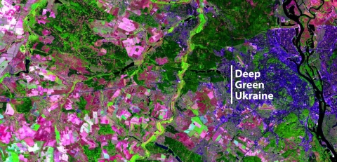
Deep Green Ukraine – is a web portal with a system that enables to find out in close-up mode how much forest has disappeared from the forest map of Ukraine and when it happened. The system is available only in pilot regions with the aim to scale up its monitoring capacities to the whole territory of Ukraine. The system is also planned to be transferred to the relevant government agencies to provide administration and technical support.
Deep Green Ukraine has adopted a technology that tracks illegal logging using satellite data. The system classifies all logging, mainly as legal or illegal, by analyzing state issued permit tickets in public databases.
For identification of forest cover changes the system uses the combination of data from optical and radar images, which allows the models to work in any season and in any weather, supporting regular updates. To do this, we have developed a new learning strategy based on two machine learning techniques – "pseudo labeling" and "knowledge distillation". How it works: for each area we have thousands of fully marked 224 by 224 pixel squares that cover a small part of the area. It enables the study of the three top architectures of deep neural networks. After training, these models are combined into an ensemble and produce a map of fellings at the regional level. New fellings (those added during the observation period) distributed respectivelly in all forests of the region depending on different types of forests and types of surfaces. We use them as pseudo-labels to teach one deep model at the oblast level, which in turn produces a map of high-precision felling in unclassified parts of the oblast. With the help of "knowledge distillation" approaches, we get one model that has a higher accuracy than three deep models combined into an ensemble.
The web portal developed by the project team uses the following data: data obtained from neural networks on changes in forest cover, data from open registers and other sources (including a possibility to upload photos and videos by individual users with geodata on known to them violations of environmental legislation and illegal logging, liaison with law enforcement agencies of the country). The sytem produces the marked poligons that highlight the possible illegal logging areas, including marking of other types of the felling areas within specific period of time. The results than could be cheked for field confirmation by different state official or independent monitoring actors.
Deep Green Ukraine is implemented by the joint efforts of the Space Research Institute of NASU and SSAU, NGO “Government Monitoring Center”, and the “Forest Initiatives and Communities” NGO (ForestCom).
The development of the Deep Green Ukraine system was made possible by winning the Open Data Challenge, implemented within the USAID/UK aid international technical assistance project “Transparency and Accountability in Public Administration and Services/TAPAS” with the support of the Ministry of Digital Transformation of Ukraine. The activities of the Forest Initiatives and Communities NGO also is supported by the US Forest Service.
The DGU web portal is developed by magneticonemt.com based on the DeepForest prototype created by ForestCom team in 2020 with the support of NGO "Environmental Investigation Agency" (EIA) and the ClearCut system developed by an IT company "Quantum" jointly with the Society for Environmental GIS in Ukraine (SCGIS Ukraine).


