Modellierung, DSS, Simulation, Optimierung

Englisch
Innovation
Yes
E-Mail des Eigentümers oder Autors
Voting
0%
Titel (Abkürzung)
HeProMo
Kurze Beschreibung
HeProMo is an IT-based tool to predict the costs of timber harvesting scenarios under different aspects such as harvester logging. It allows certain settings to reflect the real situations in the forest. It provides preliminary costing and sensitivity analysis.
Digitale Lösung
Yes
Zusammenfassung

HeProMo is an IT-based tool to predict the costs of timber harvesting scenarios under different aspects such as harvester logging. It allows certain settings to reflect the real situations in the forest. It provides preliminary costing and sensitivity analysis. estimation of productivity and cost for wood harvesting operations (preliminary costing). Writing and controlling offers for wood harvesting operations. Estimation of variables and their importance (sensitivity analysis). Well suitable for application in teaching , eductaion and research to identify key contributing factors and assessmen of their influence on the results. The productivity model (HeProMO) predicts quickly and with a good accurancy the costs for concrete timber harvestin scenarios. It allows the identification of optimization possibilities. The application is quite easy to handle and gives a solid basis for good economic choices.

Eigentümer oder Autorenorganisation
Eidgenössische Forschungsanstalt WSl
Name des Eigentümers oder Autors
Oliver Thess
Organisation der Reporter
BFH Berne University of Applied Sciences
Name des Reporters
Moritz Dreher
E-Mail des Reporters
Hauptbild
BP - Rosewood - V1
NO
Herkunftsland
Schweiz
Titel (nationaler Name)
HeProMo
Umfang der Anwendung
Projekt, in dessen Rahmen dieses Factsheet erstellt wurde
Hat Video
no
Englisch
Innovation
Yes
E-Mail des Eigentümers oder Autors
Voting
0%
Titel (Abkürzung)
SorSim
Kurze Beschreibung
<table border="0" cellpadding="0" cellspacing="0" style="width:354px;" width="354"> <tbody> <tr height="60"> <td height="60" style="height:60px;width:354px;">IT-based simulation (SorSim) for revenue estimation for single trees or tree stands. Modelling of the stem form, height, diameter at breast height (DBH) from tree species.&nbsp; Supports decision makers in production- and utilization processes.</td> </tr> </tbody> </table>
Digitale Lösung
Yes
Zusammenfassung
IT-based simulation (SorSim) for revenue estimation for single trees or tree stands. Modelling of the stem form, height, diameter at breast height (DBH) from tree species.  Supports decision makers in production- and utilization processes. SorSim allows an adequate calculation of the revenues of single trees and tree stands with the information’s of quality, quantity and the assortment. The information basis includes tree species, tree age (height), stem-form. SorSim is an IT-based tool which allows to predict values on single tree-level and tree stands
Eigentümer oder Autorenorganisation
Eidgenössische Forschungsanstalt WSL
Name des Eigentümers oder Autors
Renato Lemm
Organisation der Reporter
BFH Berne University of Applied Sciences
Name des Reporters
Moritz Dreher
E-Mail des Reporters
Hauptbild
BP - Rosewood - V1
NO
Herkunftsland
Schweiz
Titel (nationaler Name)
Holzzortimentssimulations
Umfang der Anwendung
Projekt, in dessen Rahmen dieses Factsheet erstellt wurde
Hat Video
no
Englisch
Innovation
Yes
E-Mail des Eigentümers oder Autors
Voting
0%
Schlüsselwörter
Titel (Abkürzung)
SiWaWa 2.0
Kurze Beschreibung
<table border="0" cellpadding="0" cellspacing="0" style="width:359px;" width="358"> <tbody> <tr height="60"> <td height="60" style="height:60px;width:359px;">A simple forest growth simulation model for practitioner (Android-App). SiWaWa needs only the number of the stems [N], the basal area per hectare [G] of a certain stand to generate separated the stem distribution curve according to the DBH-classes.</td> </tr> </tbody> </table>
Digitale Lösung
Yes
Zusammenfassung
A simple forest growth simulation model for practitioner (Android-App). SiWaWa needs only the number of the stems [N], the basal area per hectare [G] of a certain stand to generate separated the stem distribution curve according to the DBH-classes. Free available Android-App, which could be used in the following fields:
1. Strategy: Goal dimension of the trees, cutting time
2. Care concept: Coordination of harvesting time, optimization of productivity
3. Measurements: Urgency and priority
4. Analysis: Starting point and forest development without interventions. Definition of intervention measures and simulation. SiWaWa 2.0 supports the decision makers in two aspects: Silvicultural and forest planning. It supports the foresters in a better understanding of the state point and forest development.
Eigentümer oder Autorenorganisation
BFH Berne University of Applied Sciences
Name des Eigentümers oder Autors
Christian Rosset
Organisation der Reporter
BFH Bern University of Applied Sciences
Name des Reporters
Moritz Dreher
E-Mail des Reporters
Hauptbild
Logo des Projekts
BP - Rosewood - V1
NO
Herkunftsland
Schweiz
Titel (nationaler Name)
Waldwachstumssimulationsmodell
Umfang der Anwendung
Projekt, in dessen Rahmen dieses Factsheet erstellt wurde
Hat Video
no
Englisch
Innovation
Yes
E-Mail des Eigentümers oder Autors
Voting
0%
Titel (Abkürzung)
reFlex
Digitale Lösung
Yes
Zusammenfassung
Contactless survey of forest and non-forest ecosystems. Determination of dendrometric parameters of trees, state of forest transport network.
Eigentümer oder Autorenorganisation
National Forest Centre - Forest Research Institute
Name des Eigentümers oder Autors
Ivan Sačkov
Hauptbild
BP - Rosewood - V1
NO
Umfang der Anwendung
Projekt, in dessen Rahmen dieses Factsheet erstellt wurde
Hat Video
no
Englisch
Innovation
Yes
E-Mail des Eigentümers oder Autors
Voting
0%
Startjahr
2015
Endjahr
2018
Titel (Abkürzung)
RemBioFor
Kurze Beschreibung
R&amp;D project, which aim is to work out the complex method of defining selected forest stand descriptions as well as aboveground biomass and carbon sequestration, based on the use of remote sensing for the purposes of forest management planning.
Digitale Lösung
Yes
Zusammenfassung

The aim of the project was to work out the complex method of defining selected forest stand descriptions as well as aboveground biomass and carbon sequestration, based on the use of remote sensing for the purposes of forest management planning.

Among main goals were:

  • acquisition and processing of remote sensing, laboratory and field data,
  • determining the amount of biomass and carbon in the forest based on radar data,
  • development of methods for the inventory of selected stand descriptions, growing stock and biomass with the use of active remote sensing techniques,
  • local correction of dendrometric volume equations based on terrestrial laser scanning data (TLS),
  • development of the merchantable volume conversion factors into biomass and carbon.

Results of the project allow to: reduce time needed to carry out the work of the forest management, especially inventory of growing stock; obtain higher accuracy of the CO2 balance, biomass and annual allowable cut calculations; determine growing stock for any forest area; reduce cost of field work in forest management.

Eigentümer oder Autorenorganisation
Instytut Badawczy Leśnictwa
Name des Eigentümers oder Autors
Krzysztof Stereńczak
Organisation der Reporter
Łukasiewicz Research Network - Wood Technology Institute (ITD)
Name des Reporters
Dobrochna Augustyniak-Wysocka
Projekt-Referenz
Remote sensing based assessment of woody biomass and carbon storage in forests (REMBIOFOR), National Centre for Research and Development within the program „Natural environment, agriculture and forestry” BIOSTRATEG, agreement no. BIOSTRATEG1/267755/4/NCBR/2015
Titel der Ressource 1
Parkitna K., Krok G., Lisańczuk M., Mitelsztedt K., Ukalski K., Magnussen S., Markiewicz A., Miścicki S., Stereńczak K. 2021. Modelling growing stock volume of forest stands with the use of selected LiDAR Area Based Approaches in various predictive models. Forestry: An International Journal of Forest Research
Hauptbild
Hauptbildunterschrift
Field work: measurement and acquisition of woody biomass (August - September 2015)
Logo der Best Practice
Logo der Hauptorganisation
Zusätzliches Bildmaterial 1
Nabe
Central-East Hub
BP - Rosewood - V1
NO
Herkunftsland
Polen
Titel (nationaler Name)
[PL] Teledetekcyjne określanie biomasy drzewnej i zasobów węgla w lasach
Umfang der Anwendung
Projekt, in dessen Rahmen dieses Factsheet erstellt wurde
Art der Veranstaltung, auf der diese BPI vorgestellt wurde
Title of the event (Study visit - T2.3)
Digital Forest Day
Hat Video
no
Englisch
Innovation
Yes
E-Mail des Eigentümers oder Autors
Mobilisierungspotenzial
high
Art des betroffenen Holzes
Woodlands and forests
Auswirkungen auf Umwelt und Biodiversität
High, since the results of forestry operations can be demonstrated in the 3D forest enviroment
Leichte Implementierung
Requires IT skills
Wirtschaftliche Auswirkungen
Positive
Arbeitsplatzeffekt
Positive
Einkommenseffekt
Positive
Spezifisches Wissen erforderlich
Comprehensive database, coding skills, understanding of forestry processes.
Voting
0%
Startjahr
2018
Endjahr
2020
Kurze Beschreibung
Virtual forest is an application, which can be used in participatory planning of land use, guidance of forest owners and for combining interests of different stakeholder groups concerning utilization of natural resources and areas.
Digitale Lösung
Yes
Zusammenfassung

Virtual forest 2.0 is a research and development project that has developed a digital application to enable the visualization of forest resources and spatial data in 3D. A virtual forest is software that can be utilized in participatory land use planning, advising forest owners, and taking into account the goals of user and interest groups in the areas.The virtual forest can be used to increase citizens' understanding of different forest management options and to illustrate the landscape effects of a forest plan. The virtual forest can be used to visualize the holdings of any forest owner, and the application is compatible with various information systems in the forest industry.The virtual forest 2.0 uses open QGIS geographic information system to generate changes in forest patterns or tree data, habitat data and terrain data in a virtual 3D-visualization.  The free downloadable Virtual Forest 2.0 application was released in October 2020.

Eigentümer oder Autorenorganisation
Lapland University of Applied Sciences
Name des Eigentümers oder Autors
Markus Korhonen
Organisation der Reporter
Lapland University of Applied Sciences
Name des Reporters
Merja Laajanen
E-Mail des Reporters
Hauptbild
Logo der Hauptorganisation
Zusätzliches Bildmaterial 1
Nabe
Northern Hub
BP - Rosewood - V1
NO
Potenzial für Nachhaltigkeit - Wert
Medium
Herkunftsland
Finnland
Titel (nationaler Name)
Virtuaalimetsä 2.0
Umfang der Anwendung
Projekt, in dessen Rahmen dieses Factsheet erstellt wurde
Rosewood Video
Video ansehen
ROSEWOOD4.0 features in this video Finland's "Virtual Forest 2.0", which is a new innovation tool that enables efficient visualization of forest resource and spatial data in 3D. It can be used for example in participatory planning of land use and as a gui
Hat Video
yes
Englisch
Innovation
Yes
E-Mail des Eigentümers oder Autors
Mobilisierungspotenzial
High, the KWH4.0 as a competence hub supports a wide range of projects and digital solutions, which in turn support wood mobilization.
Potenzial für Nachhaltigkeit
KWH4.0 increases sustainability through several smart solutions which improve resource efficiency of harvesting operations or sustainable choices in forest management.
Auswirkungen auf Umwelt und Biodiversität

Other solutions from the KWH4.0 network address sensor-supported forest monitoring in order to increase resilience against climate change.

Leichte Implementierung
The KWH4.0 has received ERDF funding to start working. A challenge can be the core collaboration from both sides, forestry and ICT, needed to kick off activities.
Voting
0%
Kurze Beschreibung
<table border="0" cellpadding="0" cellspacing="0" style="width:492px;" width="492"> <tbody> <tr height="60"> <td height="60" style="height:60px;width:492px;">Forest and Wood 4.0 - the forest cluster becomes smart</td> </tr> </tbody> </table>
Digitale Lösung
Yes
Zusammenfassung

The Center of Excellence for Forestry 4.0 is developing Industry 4.0 digitalization concepts for the forest and wood cluster. The driving force behind this approach is a closely cooperating working group of companies, research centers and the Forestry Education Center  North-Rhine Westphalia as a practical testbed.New, intelligent and decentrally acting machines, devices, services and people, will enable the cluster to optimize its complex value-added networks, develop new business models and meet current challenges from ecology, economy and climate change. Existing approaches address the complexity of structures and processes, and the conflicting demands on forest management only insufficiently. To "smartify" the forest and wood cluster, existing competencies from industry, science and administration must be bundled: The goal of KWH4.0 is to create a know-how base and infrastructures, and to implement forest and wood 4.0 components via innovative Smart Forest Labs. The Smart Forest Labs serve as experimental forestry laboratories in which developed components, systems and processes are tested, standardization advanced, concepts disseminated, and actors trained. Developed concepts and standards are continuously published as practical recommendations, a first version of the communication infrastructure S3I (Internet of Things application) has been established. In addition, there is an increasingly smart fleet: forestry machines have been upgraded to retrieve digital information (GPS position, fuel consumption, production data, etc.) and at the same time networked via alternative radio standards with machines in regions where mobile communication is not possible.

Eigentümer oder Autorenorganisation
RIF Institut für Forschung und Transfer e.V.
Name des Eigentümers oder Autors
Frank Heinze
Organisation der Reporter
FBZ
Name des Reporters
Marie-Charlotte Hoffmann, Elke Hübner-Tennhoff
Hauptbild
Logo der Best Practice
Logo des Projekts
Zusätzliches Bildmaterial 1
Zusätzliches Bildmaterial 2
Zusätzliches Bildmaterial 3
Nabe
Central-West Hub
BP - Rosewood - V1
NO
Potenzial für Nachhaltigkeit - Wert
Very Positive
Herkunftsland
Deutschland
Titel (nationaler Name)
Kompetenzzentrum Wald und Holz 4.0
Umfang der Anwendung
Projekt, in dessen Rahmen dieses Factsheet erstellt wurde
Art der Veranstaltung, auf der diese BPI vorgestellt wurde
Title of the event (Study visit - T2.3)
ROSEWOOD4.0 Study-Tour and Seminar: Digitalization – the virtual forest
Rosewood Video
Video ansehen
KWH 4.0 - Wald und Holz 4.0 Competence Center
Hat Video
yes
Englisch
Innovation
Yes
E-Mail des Eigentümers oder Autors
Voting
0%
Startjahr
2018
Kurze Beschreibung
Climafor is a method and a software under development that allows the comparison of carbon balances from two silvicultural itineraries. It takes into account carbon sequestration in the forest, storage in wood products and the substitution effects generated by the use of wood (material or energy).
Digitale Lösung
No
Zusammenfassung

Taking into account the carbon issue in forest management is becoming more and more important in France, giving rise to research and development projects. The Climafor software responds to a challenge: to make carbon calculations easier to access and less time consuming. The data sources used (production tables, calculation coefficients) are now well known. Climafor integrates them into a single tool, which does not require any special training. The calculations are instantaneous and the results can be used directly in a forest carbon project. The calculations made by the software are based on production tables for each species and different coefficients from research. The software will be continuously improved by updating the different parameters and adding new tables. For the moment, it is being developed by the IDF (Institute of Forestry Development), the R&D branch of the CNPF.

Eigentümer oder Autorenorganisation
CNPF
Name des Eigentümers oder Autors
Simon Martel
Name des Reporters
Henri Husson
E-Mail des Reporters
Hauptbild
Logo der Best Practice
Logo der Hauptorganisation
BP - Rosewood - V1
NO
Herkunftsland
Frankreich
Umfang der Anwendung
Projekt, in dessen Rahmen dieses Factsheet erstellt wurde
Rosewood Video
Video ansehen
Climafor tool
Hat Video
yes
Englisch
Innovation
Yes
E-Mail des Eigentümers oder Autors
Voting
0%
Kurze Beschreibung
<table border="0" cellpadding="0" cellspacing="0" style="width:512px;" width="512"> <tbody> <tr height="60"> <td height="60" style="height:60px;width:512px;">A lack of forest site information in Styria asks for a new approach to forest site classification and mapping. In this project the forest site classification will be based on a GIS-based geo-ecological stratification model.</td> </tr> </tbody> </table>
Digitale Lösung
Yes
Zusammenfassung

A lack of forest site information in Styria created a need for a new approach to forest site classification and mapping, considering the changing climatic conditions, which will affect the classification of forest sites and the choice of tree species. Theoretical concepts for a new approach in "dynamic site classification" existed, but the implementation of an integrated site and forest classification in for the whole forest area in Styria has been a scientific challenge. In this project the forest site classification is based on a GIS-based geo-ecological stratification model. The database is based on a digital elevation model, a geological base map, digitally available site and climate data as well as empirical site parameters. A map of forest types is derived based on several thematic maps, including information about energy, water and nutrient balance. Those parameters are modeled on the basis of point and area related data, which are then combined into forest types with a uniform combination of factors. The model allows a stratification of the forest types on all sites based on digital geo-ecological parameters. In addition to the ecological facts, each forest type is characterized by a description of silvicultural guidelines containing information on the appropriate choice of tree species, potential hazards and adaptation methods. These guidelines also describe previous experiences with the tree species and their mixtures, and will provide recommendations for the future forest management with regard to climate change.

Eigentümer oder Autorenorganisation
University of Natural Resources and Life Sciences, Vienna (BOKU)
Name des Eigentümers oder Autors
Harald Vacik
Organisation der Reporter
Holzcluster Steiermark GmbH
Name des Reporters
DI Masa Jasarevic
E-Mail des Reporters
Hauptbild
Logo der Best Practice
Logo der Hauptorganisation
Logo des Projekts
BP - Rosewood - V1
NO
Herkunftsland
Österreich
Titel (nationaler Name)
Waldtypisierung Steiermark
Umfang der Anwendung
Projekt, in dessen Rahmen dieses Factsheet erstellt wurde
Rosewood Video
Video ansehen
FORSITE (Austria) - ROSEWOOD4.0 Best Practice & Innovation
Hat Video
yes
Englisch
Innovation
Yes
Source of wood

Stemwood

E-Mail des Eigentümers oder Autors
Code
BP_CH_11
Time scale
2017 – 2019
Mobilisierungspotenzial
1 – 2 m3/ha
Art des betroffenen Holzes
Stemwood
Potenzial für Nachhaltigkeit
Very positive – currently under complete assessment (LCA)
Auswirkungen auf Umwelt und Biodiversität

Positive effect on environmental impact and forest working resilience enhancement. Also providing an environmental impact documentation system

Leichte Implementierung
Difficult - Module dependent - now partially in basic portfolio of the manufacturer (HSM)
Wirtschaftliche Auswirkungen
Due to higher potential driving speeds and thus a higher productivity as well as a lower fuel consumption under certain circumstances, a double positive effect can be noted. Also, a higher grade of profession can be reached in the supply chain by implemen
Arbeitsplatzeffekt
Higher subjective comfort and stress relief due to highly suspended working area (M2)
Einkommenseffekt
Positive / more efficient working processes / cost reduction possibility / better and enhanced working conditions in soil sensitive areas / higher productivity on low road density areas
Spezifisches Wissen erforderlich
Developing support of monitoring services to implement in the own software- and working environment; no additional knowledge needed on the use of the hardware equipped machine towards conventional machines.
Kosten der Implementierung

Individually to estimate on request:
Monitoring service introduction or development
Cloud service providing
Additional module cost (with new machine):
HVT transmission:  app. 25 000 €
Triple Bogie: app. 29 000 €
Fully-suspended drivers cab 7 500 €
Other modules on request.

Technical readiness level
Partly direct applicable – request necessary
Wichtige Voraussetzungen

https://www.hsm-forest.net/
Geiger, Chris; Greff, Daniel; Starke, Michael; Geimer, Marcus (2019): Entwicklung und Evaluation eines Wiegesystems für Forstkräne auf Basis von künstlichen neuronalen Netzen. LANDTECHNIK, Bd. 74 Nr. 5 (2019). DOI: 10.15150/lt.2019.3213.

Location
Switzerland, Saxony (Germany), Scotland, Lithuania, Romania
Implementers
Forwarder2020 Consortium
Actual status
Finished project with ongoing evaluation on demand
Anhänge
Country Region City
Germany
Lithuania
Romania
Switzerland
Scotland
Scope
National
Voting
100%
Startjahr
2017
Endjahr
2019
Kurze Beschreibung
Two newly developed forwarder prototypes with five different modules were implemented and tested in the fields under varying conditions within Europe.
Digitale Lösung
Yes
Herkunft des Holzes
Art des Holzes
Zusammenfassung

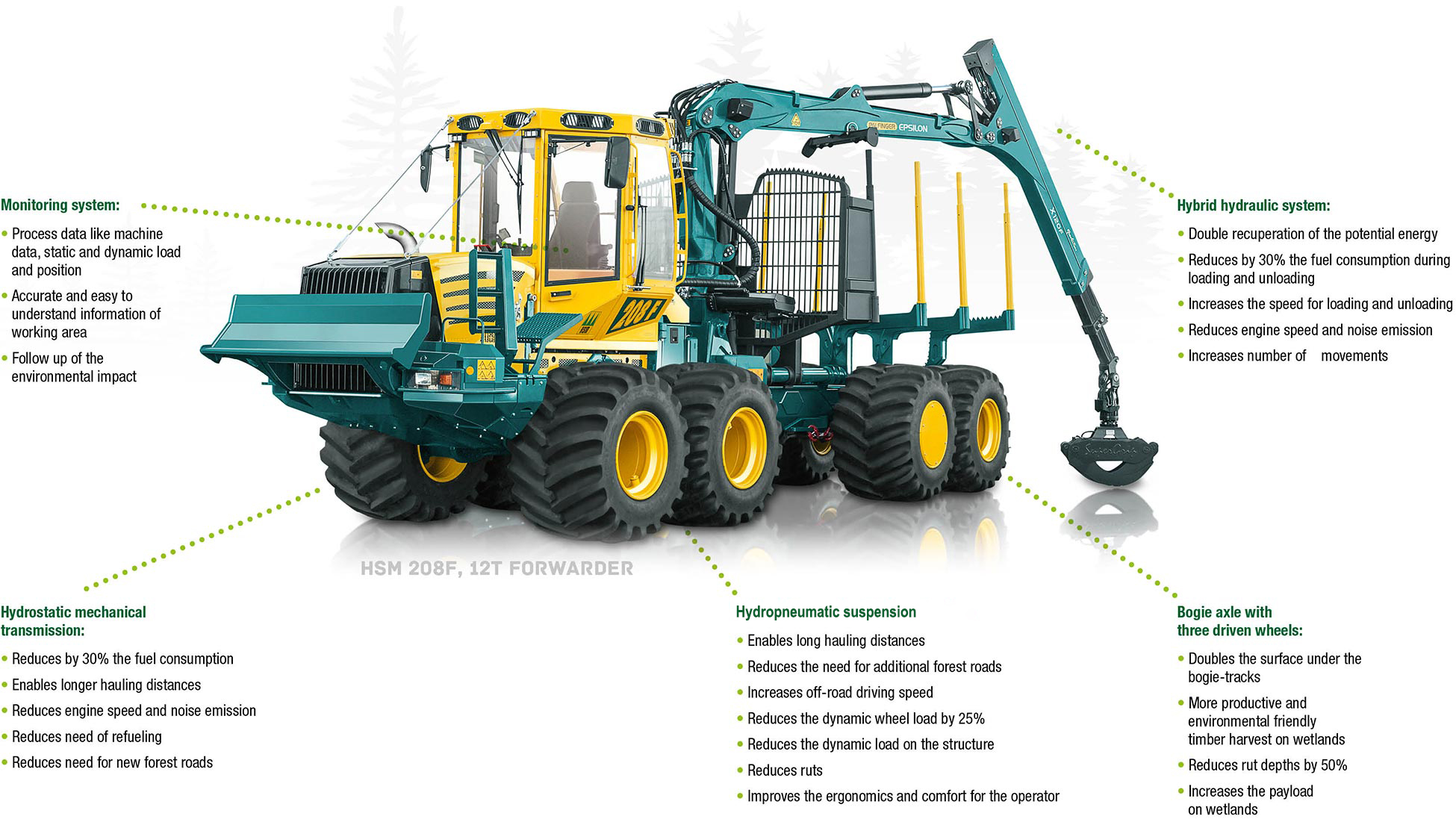
With two newly developed forwarder prototypes, five new and different modules were implemented and tested in the fields under varying production conditions within Europe. These modules are developed towards raising the productivity of the machine, improving the working conditions and lowering the ecological impact of the forwarding process. The modules contain a hydrostatic-mechanical transmission system (HVT, M1), a suspended cabin (M2), an energy regenerating and recuperating hydraulic crane (M3), a triple bogie axle for wet terrain, that can be used with or without tracks (M4) and a monitoring system to surveil and document the machine status to derive further information of production and environment (M5).

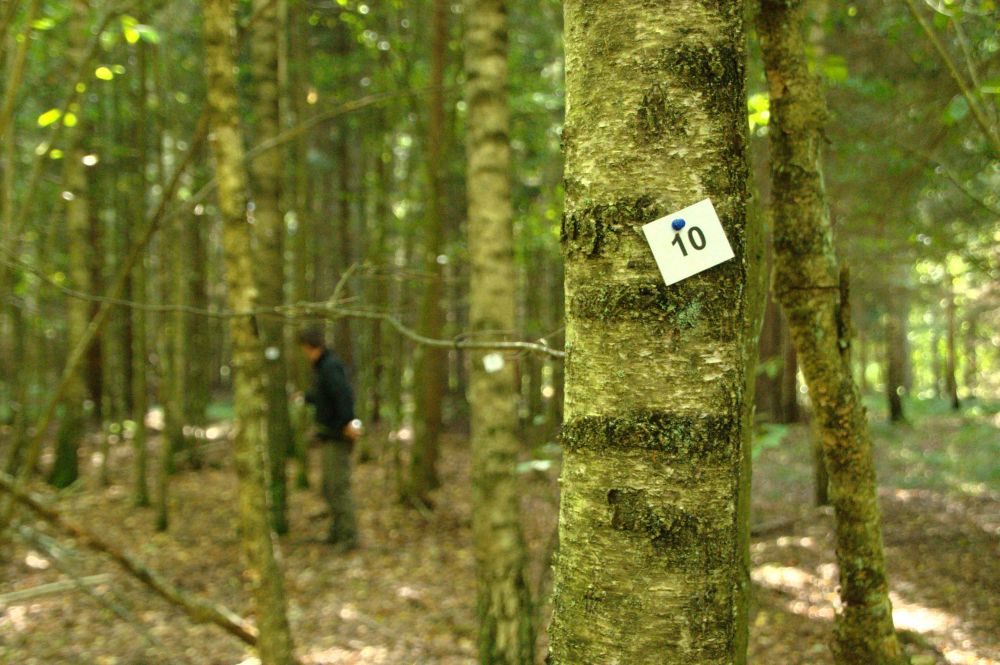
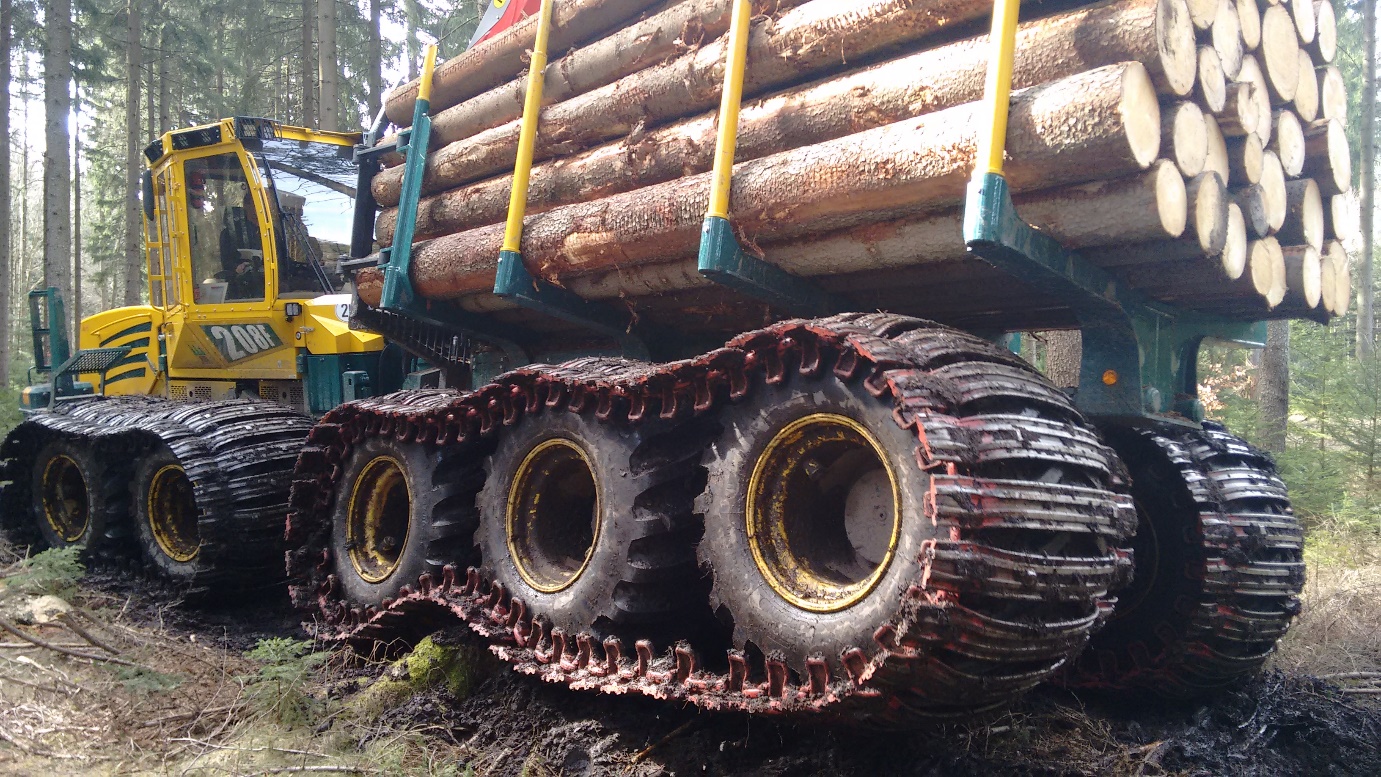
With the tests of prototype machines, the aims of development could be proven by the field tests, that were executed within the study. Especially the effect on the soils on sensitive areas, also without the use of bogie tracks, as it was tested on distributed bark beetle infested stands in Saxony, was one field of application where the advantages of tire-based working, longer bogie axle and high contact surface were positively assessed. With more experiences, the revelation of further advantages or limitations are expected.

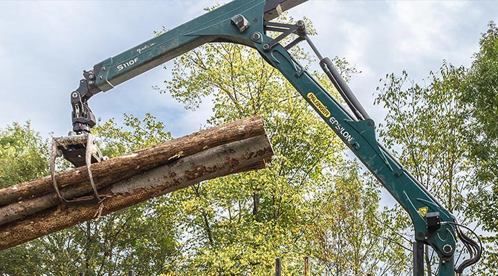
Within the field tests, all modules of the “Triple Bogie Prototype” (M3, M4, M5) were assessed with a positive effect. For wetland (Saxony) or even peatland working conditions (Scotland, Lithuania), the triple bogie showed advantages in technical accessibility but also the lower environmental impact on sensitive areas. Without the use of tracks, especially under varying, partly sensitive soil conditions the system has advantages towards other systems as the machine was able to relocate itself on own axle for long distances and provide the protection effect. The protection of ditches while entering forest stands was a positive additional effect of the system that could be observed as it acts like a built- in bridge. Due to potential high load capacity of both base machines, also a high productivity was recorded that fit or exceeded literature findings. The crane system (M3) which has also a high positive influence on the fuel consumption could withstand a fuel consumption reduction effect on its own, at is was proven under laboratory conditions.

  • With higher productivity, now due to higher driving speeds and in course of a lowered fuel consumption, the second, “HVT- Prototype” (M1, M2, M5) setup presented its advantages especially under longer hauling distances with high possible driving speeds. This machine can be especially be efficiently used in regions with low road densities.
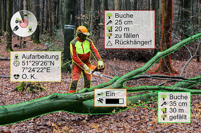
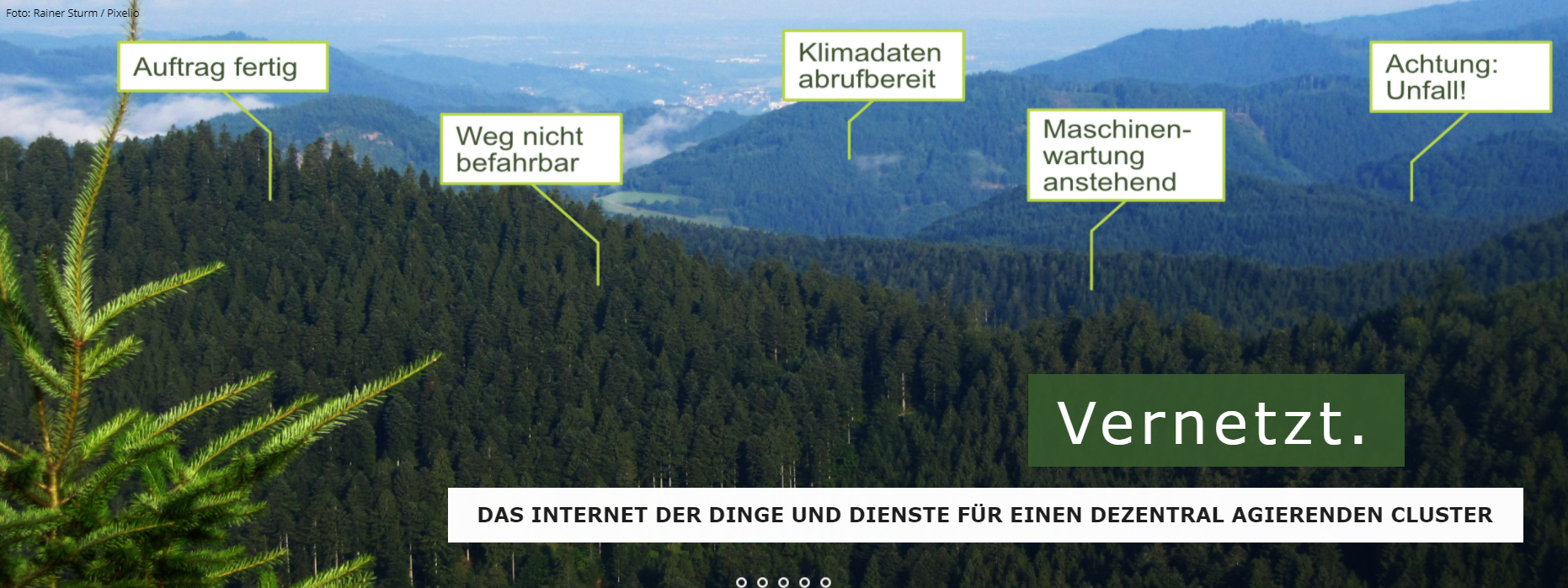
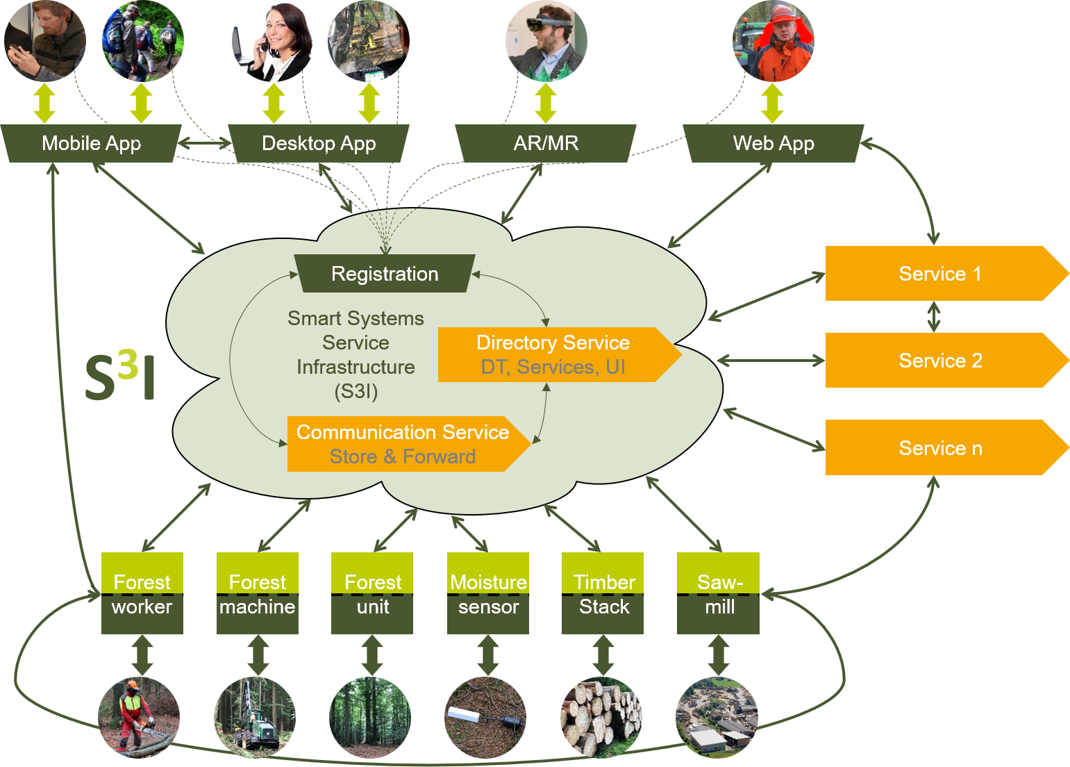
  • With the monitoring system (M5), the environmental impact and the machine behavior was actively observed and evaluated. As the here implemented iFOS system is freely configurable, it was successfully implemented in the project and could for instance be further introduced as modular environmental documentation system by forest enterprises or in public services. The separately developed data-based crane scale as stand-alone or industry 4.0 service, makes it possible to use the forwarding information in logistic applications like the energy wood supply in the wood chip logistic (Geiger et al. 2019).
Eigentümer oder Autorenorganisation
HSM Hohenloher Spezial-Maschinenbau GmbH & Co. KG
Name des Eigentümers oder Autors
Felix zu Hohenlohe
Organisation der Reporter
BFH Berne University of Applied Sciences
Name des Reporters
Moritz Dreher
E-Mail des Reporters
Projekt-Referenz
EC Horizon 2020 grant agreement No 727883
Hauptbild
Logo des Projekts
Zusätzliches Bildmaterial 1
Zusätzliches Bildmaterial 2
BP - Rosewood - V1
YES
Herkunftsland
Deutschland
Litauen
Rumänien
Schweiz
Projekt, in dessen Rahmen dieses Factsheet erstellt wurde
Hat Video
yes