Cable road layout planner

Cable road layout planner Seilaplan

DE
EN
Seilaplan: Cable road layout planner
Seilaplan is a tool that supports the design of cable roads for timber harvesting. It works as a QGis-Plugin.
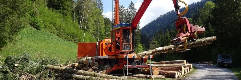
Wood extraction with cable yarder

Starting point of the calculation are terrain data (digital elevation model or field measurement data in CSV format), machine and cable road properties.
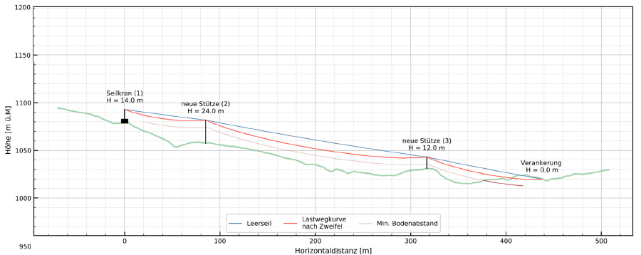
The program calculates the skyline tensile forces, the skyline sag, support saddle forces. By knowing the rope forces, critical constructions can be avoided. This increases the safety at work.

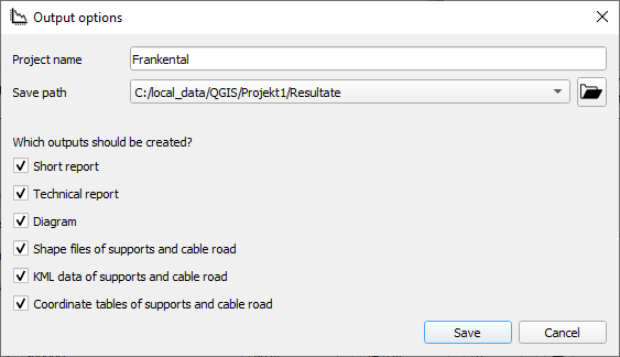
Seilaplan includes an optimization algorithm that proposes the height and location of the supports. The load path of the skyline together with the terrain profile are displayed graphically and a construction manual is generated. Coordinates and saddle height of the supports can be saved as CSV and KML data so that they are electronically available for further planning steps.

The planning of cable road layout goes much faster. The calculated routing takes advantage of the natural terrain shapes and helps to reduce overall harvesting costs in mountainous regions and steep terrain.

Anchorage, supports and rope height above ground
Regija podrijetla
2657895
Vrsta drva
Deblo
Podrijetlo drva
Šuma
Potencijal za povećanje uporabe drva
> 100'000 m³ for Switzerland
Odgovarajuća vrsta drva
stemwood and full trees
Utjecaj na okoliš i bioraznolikost

The cost reduction will allow new, poorly accessible areas to be developed and additional timber to be harvested.
This has a positive effect on the protective function of the forest in the mountains and it promotes adaptation to climate change.

Jednostavnost provedbe
Very easy
Gospodarski učinak
Reduced installation cost, improved profitability
Učinak na zapošljivost
Faster and saver skyline layout planing
Učinak na prihod
Improved profitability of logging in steep terrain
Potrebna posebna znanja
Knowledge of QGis is necessary
Troškovi provedbe (Euro - €)
100.00 €
Potencijal iskoristivosti

For forest owners and forest contractors

Ključni preduvjeti

Terrain data must be available or collected along the planned line.
Glavno područje
Upravljanje šumama, uzgoj šuma, usluge ekosustava, otpornost
Ključne riječi
cable road skyline QGis plugin mountain forest
Izazov
5. Unaprjeđenje učinkovitosti lanca opskrbe šumom na gospodarstvo i okoliš
Vrsta rješenja
Savjetodavni i uslužni alati za vlasnike šuma
Digitalno rješenje
Da
Inovacija
Da
Zemlja podrijetla
Švicarska
Regija podrijetla
2657895
Područje primjene
Kontinentalno
Početak i kraj godine
2012 - 2021
Kontakt podatci
Vlasnik ili autor
Swiss Federal Institute for Forest Research WSL
Leo Bont
Izvjestitelj
BFH Berne University of Applied Sciences
Thuer Peter
References and Resources
Referenca projekta
Bont, L. G., Moll, P. E., Ramstein, L., Frutig, F., Heinimann, H. R., & Schweier, J. (2022). SEILAPLAN, a QGIS plugin for cable road layout design. Croat J For Eng. Bont, L. G., Ramstein, L., Frutig, F., & Schweier, J. (2022). Tensile forces and deflections on skylines of cable yarders: comparison of measurements with close-to-catenary predictions. International Journal of Forest Engineering, 1-22. https://www.dora.lib4ri.ch/wsl/islandora/object/wsl%3A30255/datastream/PDF/Bont-2022-Tensile_forces_and_defl
Projekt u okviru kojeg je informativni list kreiran
Rosewood 4.0